Monaghan night lights from space
Night Light of Monaghan (Ulster) from space (Ireland) Src. Average luminocity for 10x10km area is 6.2607% and for 50x50km: 1.0978%.
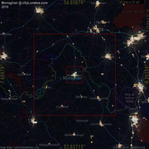
Analysis of Monaghan night lights 2016
Square area 10x10 km:
 0.5%
0.5%90-99
0.5%80-89
1%70-79
0.13%60-69
1.88%50-59
1.75%40-49
0.75%30-39
1%20-29
1%10-19
0%0-9
91.48%Square area 50x50 km:
0.06%90-99
0.07%80-89
0.09%70-79
0.2%60-69
0.22%50-59
0.3%40-49
0.1%30-39
0.27%20-29
0.25%10-19
0.12%0-9
98.33%Clear (daylight) street map image can be seen on geolist.org.
Map coordinates:
54° 39' 31.5" North, 7° 40' 11.2" West
54° 15' 0" North, 6° 58' 0" West
53° 50' 13.7" North, 6° 15' 48.7" West
Some cities around Monaghan sort by population:
• Craigavon, GB
43.5 km =27 mi,  59°
59°
• Newry, GB
41.7 km =25.9 mi,  101°
101°
• Portadown, GB
38.9 km =24.2 mi, 60°
• Armagh, GB
22.4 km =13.9 mi, 60°
• Dungannon, GB
31 km =19.3 mi,  24°
24°
• Cavan
38.6 km =24 mi,  221°
221°
• Dromore, GB
43.3 km =26.9 mi,  312°
312°
• Coalisland, GB
36.7 km =22.8 mi,  27°
27°
2962568 (p: 5,937)
Sources (retrieved 2019-11-25):
» Earth at Night: Flat Maps 2012, 2016