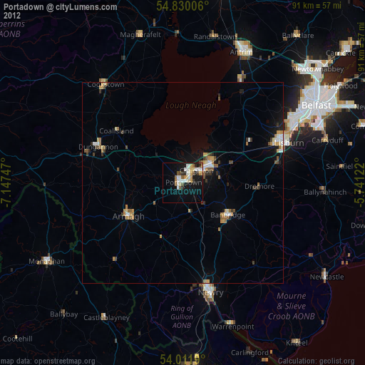
Portadown night lights from space
Night Light of Portadown (Northern Ireland) from space (United Kingdom) Src. Average luminocity for 10x10km area is 24.5706% and for 50x50km: 4.6997%.
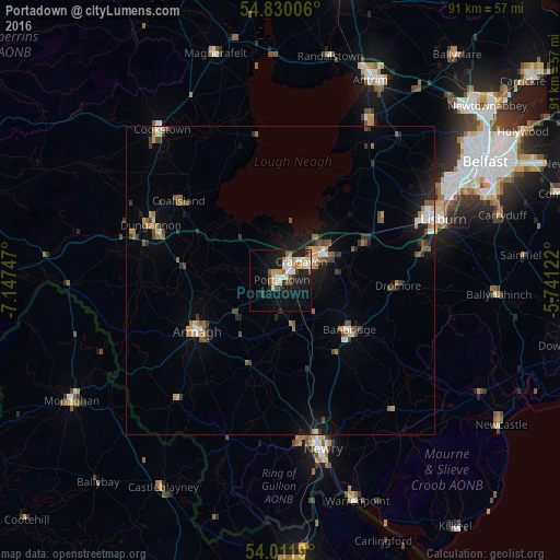
Analysis of Portadown night lights 2016
Square area 10x10 km:
 3.95%
3.95%90-99
5.14%80-89
2.99%70-79
2.63%60-69
2.87%50-59
2.15%40-49
2.75%30-39
1.56%20-29
4.19%10-19
26.2%0-9
45.57%Square area 50x50 km:
0.42%90-99
0.56%80-89
0.39%70-79
0.56%60-69
0.7%50-59
0.81%40-49
0.73%30-39
0.68%20-29
0.89%10-19
3.55%0-9
90.71%Clear (daylight) street map image can be seen on geolist.org.
Map coordinates:
54° 49' 48.2" North, 7° 8' 50.9" West
54° 25' 22.9" North, 6° 26' 39.6" West
54° 0' 42.8" North, 5° 44' 28.4" West
Some cities around Portadown sort by population:
• Lisburn
28.7 km =17.8 mi,  67°
67°
• Craigavon
4.6 km =2.9 mi,  54°
54°
• Newry
28.1 km =17.5 mi,  165°
165°
• Banbridge
13.2 km =8.2 mi,  127°
127°
• Armagh
16.5 km =10.3 mi,  240°
240°
• Dungannon
22.7 km =14.1 mi,  293°
293°
• Coalisland
21.2 km =13.2 mi,  308°
308°
• Crumlin
26.5 km =16.5 mi,  34°
34°
2640085 (p: 22,000)
Sources (retrieved 2019-11-25):
» Earth at Night: Flat Maps 2012, 2016