Luimneach night lights from space
Night Light of Luimneach (Munster) from space (Ireland) Src. Average luminocity for 10x10km area is 57.836% and for 50x50km: 4.7987%.
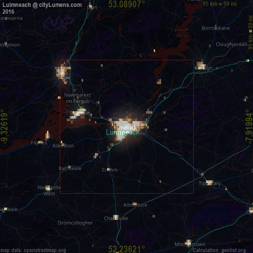
Analysis of Luimneach night lights 2016
Square area 10x10 km:
 17.46%
90-99
14.81%80-89
4.5%70-79
5.69%60-69
6.48%50-59
3.84%40-49
5.16%30-39
7.14%20-29
19.71%10-19
15.08%0-9
0.13%Square area 50x50 km:
0.88%90-99
0.76%80-89
0.41%70-79
0.38%60-69
0.51%50-59
0.59%40-49
0.78%30-39
0.7%20-29
1.33%10-19
3.65%0-9
90.01%Clear (daylight) street map image can be seen on geolist.org.
Map coordinates:
53° 5' 20.7" North, 9° 19' 34.3" West
52° 39' 53" North, 8° 37' 23" West
52° 14' 10.4" North, 7° 55' 11.8" West
Some cities around Luimneach sort by population:
• Ennis
31.5 km =19.6 mi,  309°
309°
• Shannon
16.8 km =10.4 mi,  285°
285°
• Mallow
59.1 km =36.7 mi,  180°
180°
• Thurles
55.4 km =34.4 mi,  88°
88°
• Nenagh Bridge
37.5 km =23.3 mi,  49°
49°
• Newcastle West
38.1 km =23.7 mi,  231°
231°
• Nenagh
36.1 km =22.4 mi, 52°
• Loughrea
59.3 km =36.8 mi,  3°
3°
2962943 (p: 90,054)
Sources (retrieved 2019-11-25):
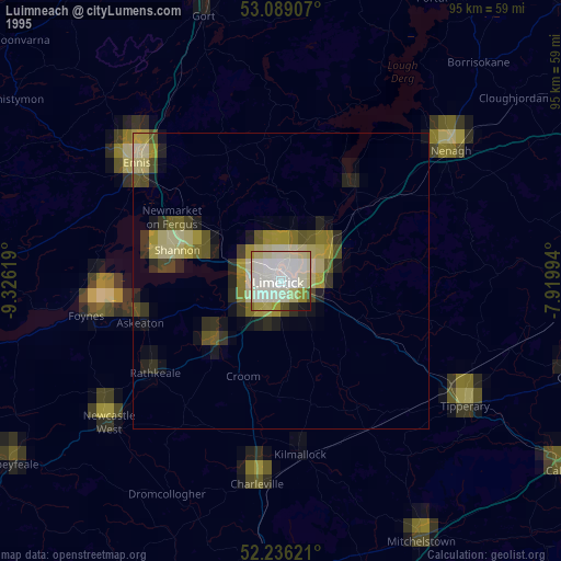
» NASA, Earths city lights 1995
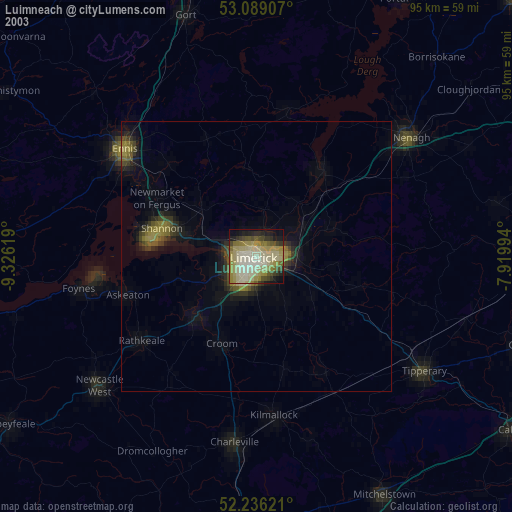
» NASA city lights 2003
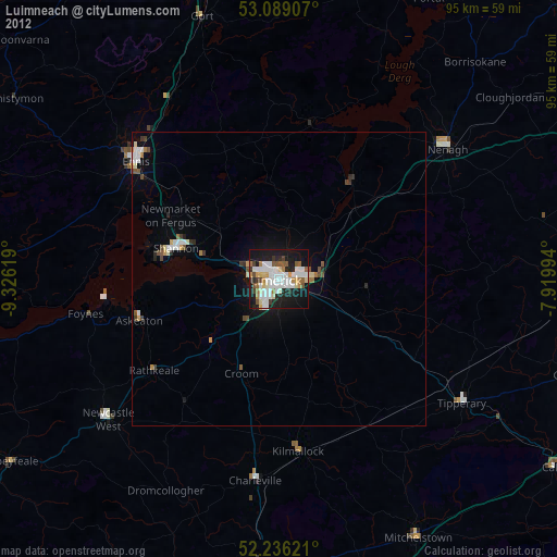
» Earth at Night: Flat Maps 2012, 2016