Thurles night lights from space
Night Light of Thurles (Munster) from space (Ireland) Src. Average luminocity for 10x10km area is 5.6601% and for 50x50km: 0.856%.
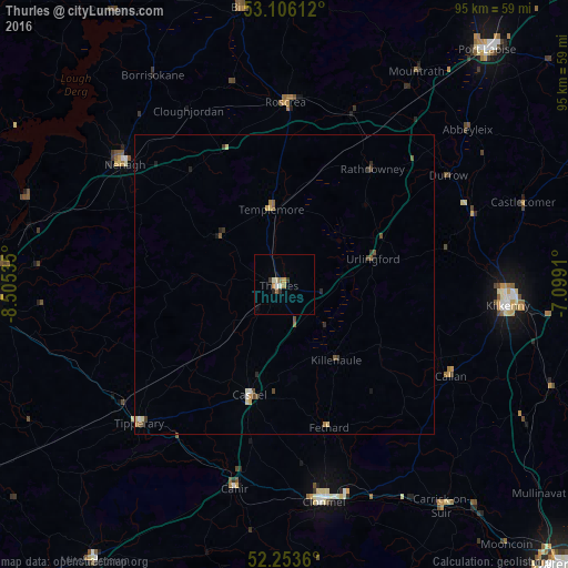
Analysis of Thurles night lights 2016
Square area 10x10 km:
 0.4%
0.4%90-99
1.19%80-89
0.93%70-79
0.66%60-69
1.19%50-59
0.4%40-49
0%30-39
1.46%20-29
0.66%10-19
0.93%0-9
92.2%Square area 50x50 km:
0.06%90-99
0.09%80-89
0.15%70-79
0.11%60-69
0.1%50-59
0.16%40-49
0.22%30-39
0.18%20-29
0.15%10-19
0.12%0-9
98.65%Clear (daylight) street map image can be seen on geolist.org.
Map coordinates:
53° 6' 22" North, 8° 30' 19.3" West
52° 40' 55" North, 7° 48' 8" West
52° 15' 13" North, 7° 5' 56.8" West
Some cities around Thurles sort by population:
• Luimneach
55.4 km =34.4 mi,  268°
268°
• Kilkenny
37.2 km =23.1 mi,  94°
94°
• Cluain Meala
37 km =23 mi,  169°
169°
• Portlaoise
51.7 km =32.1 mi,  40°
40°
• Nenagh Bridge
34.6 km =21.5 mi,  309°
309°
• Carrick-on-Suir
45.4 km =28.2 mi,  144°
144°
• Nenagh
33.2 km =20.6 mi, 307°
• Roscrea
29.9 km =18.6 mi,  0°
0°
2961214 (p: 7,588)
Sources (retrieved 2019-11-25):
» Earth at Night: Flat Maps 2012, 2016