Letterkenny night lights from space
Night Light of Letterkenny (Ulster) from space (Ireland) Src. Average luminocity for 10x10km area is 11.7823% and for 50x50km: 1.5722%.
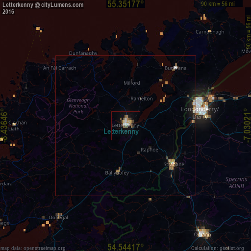
Analysis of Letterkenny night lights 2016
Square area 10x10 km:
 1.56%
1.56%90-99
1.32%80-89
1.79%70-79
0.12%60-69
2.39%50-59
1.79%40-49
2.87%30-39
1.2%20-29
0.84%10-19
4.07%0-9
82.06%Square area 50x50 km:
0.14%90-99
0.11%80-89
0.14%70-79
0.16%60-69
0.4%50-59
0.24%40-49
0.31%30-39
0.16%20-29
0.28%10-19
0.89%0-9
97.16%Clear (daylight) street map image can be seen on geolist.org.
Map coordinates:
55° 21' 6.4" North, 8° 26' 11.3" West
54° 57' 0" North, 7° 43' 60" West
54° 32' 39" North, 7° 1' 48.8" West
Some cities around Letterkenny sort by population:
• Londonderry County Borough, GB
27.6 km =17.1 mi,  79°
79°
• Derry, GB
27.6 km =17.1 mi, 78°
• Omagh, GB
47.8 km =29.7 mi,  144°
144°
• Enniskillen, GB
67.4 km =41.9 mi,  174°
174°
• Strabane, GB
22 km =13.7 mi,  129°
129°
• Limavady, GB
51.1 km =31.8 mi, 77°
• Dromore, GB
51.7 km =32.1 mi,  160°
160°
• Buncrana
27.2 km =16.9 mi,  41°
41°
2962961 (p: 16,901)
Sources (retrieved 2019-11-25):
» Earth at Night: Flat Maps 2012, 2016