Strabane night lights from space
Night Light of Strabane (Northern Ireland) from space (United Kingdom) Src. Average luminocity for 10x10km area is 8.0263% and for 50x50km: 3.3484%.
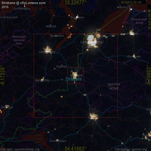
Analysis of Strabane night lights 2016
Square area 10x10 km:
 0.36%
0.36%90-99
0.12%80-89
1.08%70-79
1.32%60-69
2.87%50-59
1.56%40-49
1.56%30-39
0.72%20-29
0.6%10-19
1.32%0-9
88.52%Square area 50x50 km:
0.53%90-99
0.5%80-89
0.35%70-79
0.29%60-69
0.61%50-59
0.41%40-49
0.51%30-39
0.39%20-29
0.78%10-19
1.74%0-9
93.88%Clear (daylight) street map image can be seen on geolist.org.
Map coordinates:
55° 13' 36.4" North, 8° 10' 20.2" West
54° 49' 25.4" North, 7° 28' 9" West
54° 24' 59.9" North, 6° 45' 57.7" West
Some cities around Strabane sort by population:
• Londonderry County Borough
21.8 km =13.5 mi,  27°
27°
• Derry
21.9 km =13.6 mi, 27°
• Omagh
27.1 km =16.8 mi,  156°
156°
• Letterkenny, IE
22 km =13.7 mi,  309°
309°
• Limavady
41.6 km =25.8 mi,  52°
52°
• Cookstown
50.6 km =31.4 mi,  113°
113°
• Dromore
34.5 km =21.4 mi,  178°
178°
• Buncrana, IE
34.4 km =21.4 mi,  2°
2°
2636744 (p: 14,198)
Sources (retrieved 2019-11-25):
» Earth at Night: Flat Maps 2012, 2016