Buncrana night lights from space
Night Light of Buncrana (Ulster) from space (Ireland) Src. Average luminocity for 10x10km area is 2.698% and for 50x50km: 3.0282%.
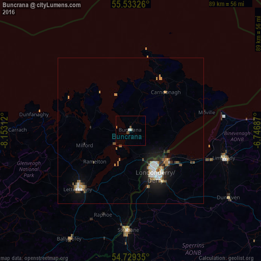
Analysis of Buncrana night lights 2016
Square area 10x10 km:
 0.75%
0.75%90-99
0.25%80-89
0%70-79
0.5%60-69
0%50-59
0.38%40-49
1%30-39
0.63%20-29
0%10-19
0%0-9
96.49%Square area 50x50 km:
0.51%90-99
0.46%80-89
0.27%70-79
0.36%60-69
0.44%50-59
0.3%40-49
0.4%30-39
0.37%20-29
0.71%10-19
2.09%0-9
94.08%Clear (daylight) street map image can be seen on geolist.org.
Map coordinates:
55° 31' 59.7" North, 8° 9' 11.2" West
55° 7' 60" North, 7° 27' 0" West
54° 43' 45.7" North, 6° 44' 48.7" West
Some cities around Buncrana sort by population:
• Londonderry County Borough, GB
17.6 km =10.9 mi,  149°
149°
• Derry, GB
17.5 km =10.9 mi, 149°
• Coleraine, GB
49.8 km =30.9 mi,  90°
90°
• Letterkenny
27.2 km =16.9 mi,  221°
221°
• Strabane, GB
34.4 km =21.4 mi,  182°
182°
• Limavady, GB
33.1 km =20.6 mi,  106°
106°
• Portstewart, GB
47.1 km =29.3 mi,  83°
83°
• Portrush, GB
51.3 km =31.9 mi, 82°
2654332 (p: 5,546)
Sources (retrieved 2019-11-25):
» Earth at Night: Flat Maps 2012, 2016