Londonderry County Borough night lights from space
Night Light of Londonderry County Borough (Northern Ireland) from space (United Kingdom) Src. Average luminocity for 10x10km area is 41.0227% and for 50x50km: 3.2084%.
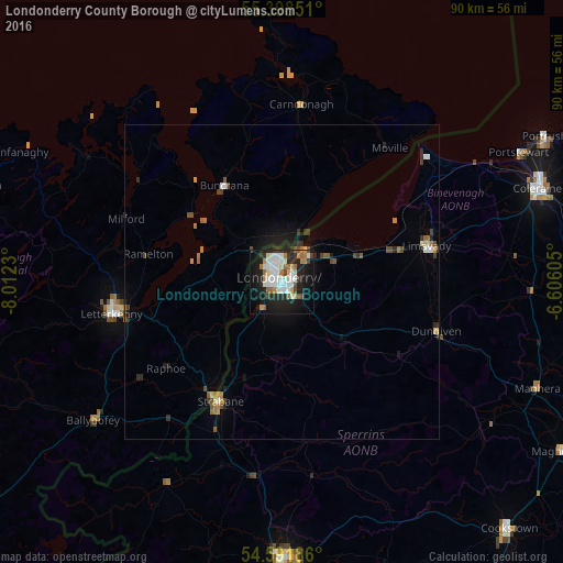
Analysis of Londonderry County Borough night lights 2016
Square area 10x10 km:
 10.05%
90-99
9.69%80-89
4.55%70-79
2.87%60-69
5.98%50-59
2.27%40-49
2.99%30-39
3.23%20-29
12.32%10-19
29.9%0-9
16.15%Square area 50x50 km:
0.52%90-99
0.46%80-89
0.29%70-79
0.26%60-69
0.54%50-59
0.33%40-49
0.46%30-39
0.44%20-29
0.91%10-19
2.1%0-9
93.68%Clear (daylight) street map image can be seen on geolist.org.
Map coordinates:
55° 23' 54.6" North, 8° 0' 44.3" West
54° 59' 50" North, 7° 18' 33" West
54° 35' 30.7" North, 6° 36' 21.8" West
Some cities around Londonderry County Borough sort by population:
• Derry
0.1 km =0.1 mi,  353°
353°
• Coleraine
43.6 km =27.1 mi,  69°
69°
• Omagh
44.2 km =27.5 mi,  179°
179°
• Letterkenny, IE
27.6 km =17.1 mi,  259°
259°
• Strabane
21.8 km =13.5 mi,  207°
207°
• Limavady
23.6 km =14.7 mi,  75°
75°
• Portstewart
43.1 km =26.8 mi,  61°
61°
• Buncrana, IE
17.6 km =10.9 mi,  329°
329°
2643734 (p: 87,153)
Sources (retrieved 2019-11-25):
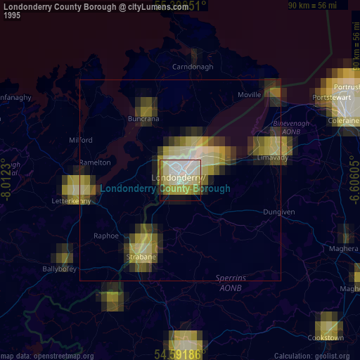
» NASA, Earths city lights 1995
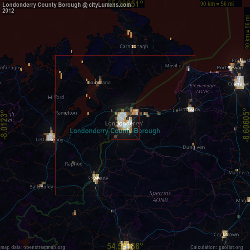
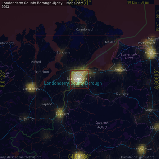
» NASA city lights 2003
» Earth at Night: Flat Maps 2012, 2016