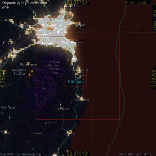
Kilquade night lights from space
Night Light of Kilquade (Leinster) from space (Ireland) Src. Average luminocity for 10x10km area is 9.1812% and for 50x50km: 8.504%.
Analysis of Kilquade night lights 2016
Square area 10x10 km:
 0%
0%90-99
0.79%80-89
1.06%70-79
2.25%60-69
0.66%50-59
1.98%40-49
2.65%30-39
1.19%20-29
1.59%10-19
4.37%0-9
83.47%Square area 50x50 km:
2.85%90-99
2.32%80-89
0.65%70-79
0.45%60-69
0.43%50-59
0.44%40-49
0.7%30-39
1.06%20-29
2.19%10-19
3.37%0-9
85.55%Clear (daylight) street map image can be seen on geolist.org.
Map coordinates:
53° 31' 3.2" North, 6° 47' 14.1" West
53° 5' 50.7" North, 6° 5' 2.8" West
52° 40' 23.4" North, 5° 22' 51.6" West
Some cities around Kilquade sort by population:
• Bray
11.8 km =7.3 mi,  355°
355°
• Wicklow
13.8 km =8.6 mi,  170°
170°
• Greystones
5 km =3.1 mi,  16°
16°
• Foxrock
19.8 km =12.3 mi,  342°
342°
• Shankill
14.6 km =9.1 mi,  349°
349°
• Cabinteely
19.8 km =12.3 mi, 345°
• Little Bray
12.1 km =7.5 mi, 348°
• Dalkey
20.1 km =12.5 mi, 356°
7870988 (p: 14,886)
Sources (retrieved 2019-11-25):
» Earth at Night: Flat Maps 2012, 2016