Blanchardstown night lights from space
Night Light of Blanchardstown (Leinster) from space (Ireland) Src. Average luminocity for 10x10km area is 86.1508% and for 50x50km: 24.8227%.
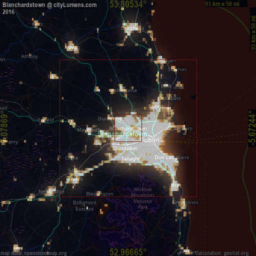
Analysis of Blanchardstown night lights 2016
Square area 10x10 km:
 35.45%
90-99
28.04%80-89
10.58%70-79
7.14%60-69
4.63%50-59
3.7%40-49
5.16%30-39
3.44%20-29
1.85%10-19
0%0-9
0%Square area 50x50 km:
8.34%90-99
5.56%80-89
1.81%70-79
1.95%60-69
1.83%50-59
1.68%40-49
2.3%30-39
2.78%20-29
5.22%10-19
11.3%0-9
57.22%Clear (daylight) street map image can be seen on geolist.org.
Map coordinates:
53° 48' 19.2" North, 7° 4' 43.3" West
53° 23' 17" North, 6° 22' 32" West
52° 57' 59.9" North, 5° 40' 20.8" West
Some cities around Blanchardstown sort by population:
• Finglas
5.2 km =3.2 mi,  88°
88°
• Lucan
5.9 km =3.7 mi,  234°
234°
• Ballyfermot
5.2 km =3.2 mi,  164°
164°
• Castleknock
1.7 km =1.1 mi,  151°
151°
• Cherry Orchard
5.8 km =3.6 mi,  181°
181°
• Palmerstown
4.2 km =2.6 mi, 182°
• Hartstown
3.5 km =2.2 mi,  279°
279°
• Chapelizod
4.9 km =3 mi, 153°
2966110 (p: 16,511)
Sources (retrieved 2019-11-25):
» Earth at Night: Flat Maps 2012, 2016