Chapelizod night lights from space
Night Light of Chapelizod (Leinster) from space (Ireland) Src. Average luminocity for 10x10km area is 95.6164% and for 50x50km: 24.6099%.
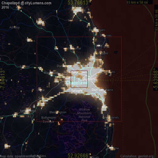
Analysis of Chapelizod night lights 2016
Square area 10x10 km:
 52.38%
90-99
30.56%80-89
8.6%70-79
5.82%60-69
1.59%50-59
1.06%40-49
0%30-39
0%20-29
0%10-19
0%0-9
0%Square area 50x50 km:
8.28%90-99
5.55%80-89
1.81%70-79
1.86%60-69
1.81%50-59
1.75%40-49
2.33%30-39
2.71%20-29
5.23%10-19
11.29%0-9
57.39%Clear (daylight) street map image can be seen on geolist.org.
Map coordinates:
53° 45' 58.1" North, 7° 2' 46.1" West
53° 20' 54.5" North, 6° 20' 34.8" West
52° 55' 36" North, 5° 38' 23.6" West
Some cities around Chapelizod sort by population:
• Blanchardstown
4.9 km =3 mi,  333°
333°
• Clondalkin
4.5 km =2.8 mi,  233°
233°
• Crumlin
3.5 km =2.2 mi,  147°
147°
• Ballyfermot
1 km =0.6 mi, 231°
• Castleknock
3.2 km =2 mi,  335°
335°
• Cherry Orchard
2.7 km =1.7 mi,  239°
239°
• Palmerstown
2.3 km =1.4 mi,  274°
274°
• Greenhills
3.1 km =1.9 mi,  120°
120°
2965525 (p: 5,296)
Sources (retrieved 2019-11-25):
» Earth at Night: Flat Maps 2012, 2016