Castleknock night lights from space
Night Light of Castleknock (Leinster) from space (Ireland) Src. Average luminocity for 10x10km area is 92.8929% and for 50x50km: 24.6479%.
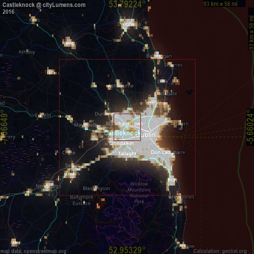
Analysis of Castleknock night lights 2016
Square area 10x10 km:
 44.97%
90-99
31.08%80-89
9.39%70-79
6.75%60-69
3.97%50-59
1.59%40-49
2.25%30-39
0%20-29
0%10-19
0%0-9
0%Square area 50x50 km:
8.28%90-99
5.52%80-89
1.8%70-79
1.86%60-69
1.84%50-59
1.68%40-49
2.3%30-39
2.76%20-29
5.22%10-19
11.48%0-9
57.26%Clear (daylight) street map image can be seen on geolist.org.
Map coordinates:
53° 47' 32.1" North, 7° 3' 59.4" West
53° 22' 29.4" North, 6° 21' 48.1" West
52° 57' 11.8" North, 5° 39' 36.9" West
Some cities around Castleknock sort by population:
• Finglas
4.7 km =2.9 mi,  70°
70°
• Blanchardstown
1.7 km =1.1 mi,  331°
331°
• Ballyfermot
3.6 km =2.2 mi,  170°
170°
• Cherry Orchard
4.4 km =2.7 mi,  192°
192°
• Palmerstown
2.9 km =1.8 mi,  199°
199°
• Greenhills
6 km =3.7 mi,  138°
138°
• Hartstown
4.7 km =2.9 mi,  295°
295°
• Chapelizod
3.2 km =2 mi,  155°
155°
2965599 (p: 8,301)
Sources (retrieved 2019-11-25):
» Earth at Night: Flat Maps 2012, 2016