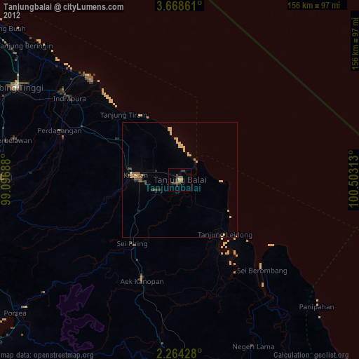
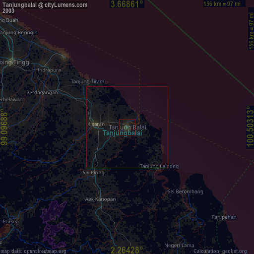
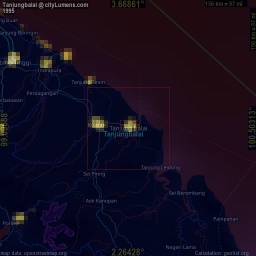
Tanjungbalai night lights from space
Night Light of Tanjungbalai (North Sumatra) from space (Indonesia) Src. Average luminocity for 10x10km area is 21.0238% and for 50x50km: 3.0917%.
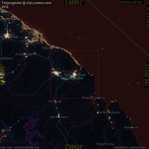
Analysis of Tanjungbalai night lights 2016
Square area 10x10 km:
 0.87%
0.87%90-99
1.73%80-89
1.08%70-79
4.98%60-69
5.84%50-59
6.28%40-49
3.25%30-39
1.52%20-29
1.73%10-19
6.28%0-9
66.45%Square area 50x50 km:
0.09%90-99
0.29%80-89
0.16%70-79
0.33%60-69
0.48%50-59
1.68%40-49
0.44%30-39
0.16%20-29
0.44%10-19
1.11%0-9
94.83%Clear (daylight) street map image can be seen on geolist.org.
Map coordinates:
3° 40' 7" North, 99° 5' 48.8" East
2° 58' 0" North, 99° 48' 0" East
2° 15' 51.4" North, 100° 30' 11.3" East
Some cities around Tanjungbalai sort by population:
• Pematangsiantar
81.2 km =50.5 mi,  269°
269°
• Kisaran
20.5 km =12.7 mi,  275°
275°
• Tebingtinggi
81.4 km =50.6 mi,  299°
299°
• Rantauprapat
96.4 km =59.9 mi,  177°
177°
• Pekan Bahapal
71.4 km =44.4 mi, 283°
• Bandar
102.1 km =63.4 mi, 183°
• Teluk Nibung
4.2 km =2.6 mi,  25°
25°
• Parapat
101.8 km =63.3 mi,  250°
250°
1213547 (p: 142,506)
Sources (retrieved 2019-11-25):
» NASA, Earths city lights 1995
» NASA city lights 2003
» Earth at Night: Flat Maps 2012, 2016