Kalianget night lights from space
Night Light of Kalianget (East Java) from space (Indonesia) Src. Average luminocity for 10x10km area is 15.0758% and for 50x50km: 2.9629%.
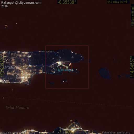
Analysis of Kalianget night lights 2016
Square area 10x10 km:
 0%
0%90-99
0.43%80-89
1.52%70-79
5.41%60-69
1.3%50-59
0.87%40-49
2.38%30-39
2.16%20-29
6.71%10-19
11.47%0-9
67.75%Square area 50x50 km:
0.05%90-99
0.28%80-89
0.29%70-79
0.42%60-69
0.18%50-59
0.18%40-49
0.77%30-39
1.02%20-29
1.21%10-19
2.62%0-9
92.98%Clear (daylight) street map image can be seen on geolist.org.
Map coordinates:
6° 21' 19.4" South, 113° 14' 21.6" East
7° 3' 13.3" South, 113° 56' 32.8" East
7° 45' 3.5" South, 114° 38' 44.1" East
Some cities around Kalianget sort by population:
• Situbondo
72.9 km =45.3 mi,  174°
174°
• Pamekasan
52.9 km =32.9 mi,  257°
257°
• Sumenep
9.3 km =5.8 mi,  296°
296°
• Besuki
80.3 km =49.9 mi,  199°
199°
• Sampang
79 km =49.1 mi, 259°
• Balung
75.6 km =47 mi,  182°
182°
• Panji
76.7 km =47.7 mi, 166°
• Panarukan
72.1 km =44.8 mi, 182°
1641977 (p: 23,897)
Sources (retrieved 2019-11-25):
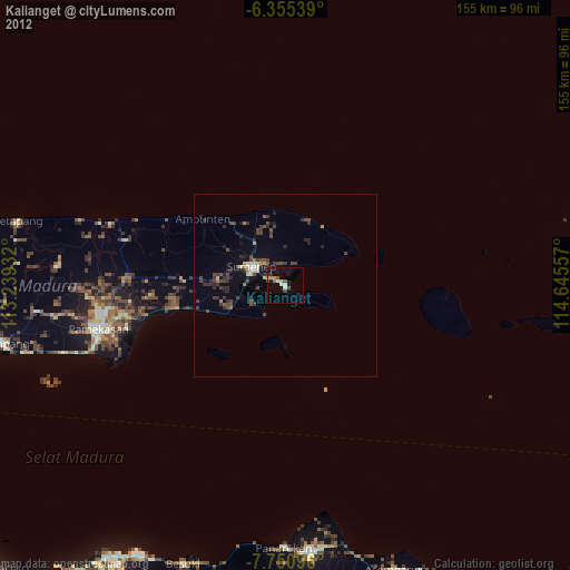
» Earth at Night: Flat Maps 2012, 2016