Situbondo night lights from space
Night Light of Situbondo (East Java) from space (Indonesia) Src. Average luminocity for 10x10km area is 40.2397% and for 50x50km: 6.5903%.
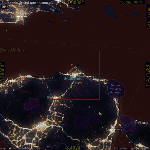
Analysis of Situbondo night lights 2016
Square area 10x10 km:
 2.48%
2.48%90-99
8.68%80-89
4.13%70-79
7.85%60-69
3.1%50-59
1.24%40-49
12.81%30-39
9.3%20-29
13.64%10-19
36.16%0-9
0.62%Square area 50x50 km:
0.19%90-99
0.98%80-89
0.64%70-79
0.59%60-69
0.56%50-59
0.88%40-49
2.23%30-39
1.65%20-29
1.82%10-19
5.49%0-9
84.98%Clear (daylight) street map image can be seen on geolist.org.
Map coordinates:
7° 0' 32" South, 113° 18' 23.9" East
7° 42' 22.4" South, 114° 0' 35.1" East
8° 24' 8.7" South, 114° 42' 46.4" East
Some cities around Situbondo sort by population:
• Jember
62.1 km =38.6 mi,  213°
213°
• Bondowoso
31 km =19.3 mi,  221°
221°
• Besuki
34.5 km =21.4 mi,  264°
264°
• Balung
10.7 km =6.6 mi,  253°
253°
• Panji
10.1 km =6.3 mi,  102°
102°
• Panarukan
10.1 km =6.3 mi,  272°
272°
• Wongsorejo
53.5 km =33.2 mi,  126°
126°
• Kraksaan
67.8 km =42.1 mi, 265°
1626801 (p: 600,000)
Sources (retrieved 2019-11-25):
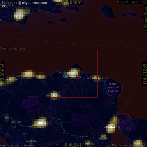
» NASA, Earths city lights 1995
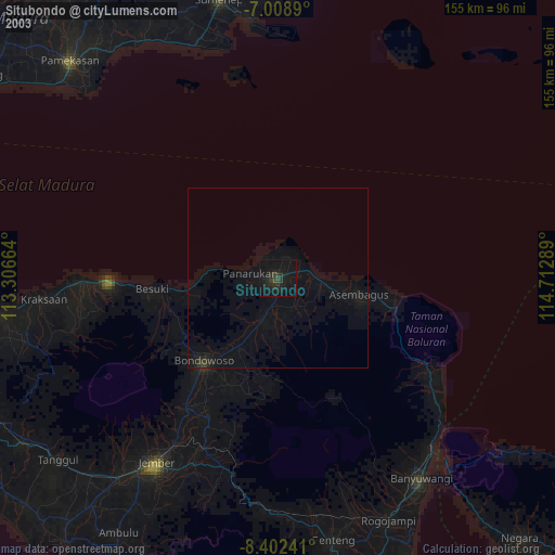
» NASA city lights 2003
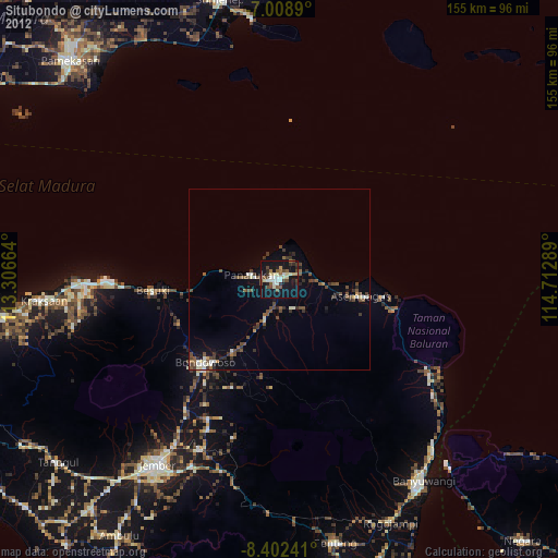
» Earth at Night: Flat Maps 2012, 2016