Balung night lights from space
Night Light of Balung (East Java) from space (Indonesia) Src. Average luminocity for 10x10km area is 10.845% and for 50x50km: 7.1155%.
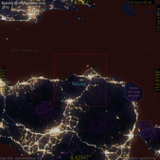
Analysis of Balung night lights 2016
Square area 10x10 km:
 0%
0%90-99
1.65%80-89
0.83%70-79
1.24%60-69
1.24%50-59
0%40-49
5.99%30-39
2.27%20-29
0%10-19
10.95%0-9
75.83%Square area 50x50 km:
0.19%90-99
1.02%80-89
0.66%70-79
0.72%60-69
0.58%50-59
0.96%40-49
2.41%30-39
1.78%20-29
2.14%10-19
6.32%0-9
83.23%Clear (daylight) street map image can be seen on geolist.org.
Map coordinates:
7° 2' 9.7" South, 113° 12' 48.8" East
7° 43' 60" South, 113° 55' 0" East
8° 25' 46.1" South, 114° 37' 11.3" East
Some cities around Balung sort by population:
• Situbondo
10.7 km =6.6 mi,  73°
73°
• Jember
54.3 km =33.7 mi,  206°
206°
• Bondowoso
22.6 km =14 mi, 207°
• Besuki
24.1 km =15 mi,  269°
269°
• Panji
20.2 km =12.6 mi,  87°
87°
• Panarukan
3.5 km =2.2 mi,  3°
3°
• Wongsorejo
60.5 km =37.6 mi,  118°
118°
• Kraksaan
57.4 km =35.7 mi, 267°
1650460 (p: 47,631)
Sources (retrieved 2019-11-25):
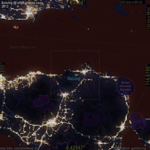
» Earth at Night: Flat Maps 2012, 2016