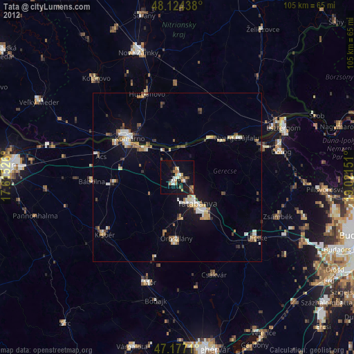
Tata night lights from space
Night Light of Tata (Komárom-Esztergom) from space (Hungary) Src. Average luminocity for 10x10km area is 13.1548% and for 50x50km: 4.988%.
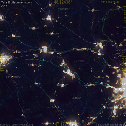
Analysis of Tata night lights 2016
Square area 10x10 km:
 0%
0%90-99
1.19%80-89
1.19%70-79
0.89%60-69
2.98%50-59
3.87%40-49
1.49%30-39
2.83%20-29
1.34%10-19
16.67%0-9
67.56%Square area 50x50 km:
0.63%90-99
0.9%80-89
0.3%70-79
0.49%60-69
0.67%50-59
0.72%40-49
0.57%30-39
0.66%20-29
0.57%10-19
4.68%0-9
89.81%Clear (daylight) street map image can be seen on geolist.org.
Map coordinates:
48° 7' 27.8" North, 17° 36' 54.9" East
47° 39' 10.4" North, 18° 19' 6.2" East
47° 10' 37.6" North, 19° 1' 17.4" East
Some cities around Tata sort by population:
• Tatabánya
9.4 km =5.8 mi,  143°
143°
• Komárno, SK
19.1 km =11.9 mi,  310°
310°
• Oroszlány
18.5 km =11.5 mi,  181°
181°
• Komárom
18 km =11.2 mi,  303°
303°
• Hurbanovo, SK
25.9 km =16.1 mi,  338°
338°
• Nyergesújfalu
21.5 km =13.4 mi,  56°
56°
• Ács
23.9 km =14.9 mi,  286°
286°
• Lábatlan
17 km =10.6 mi,  51°
51°
3044083 (p: 23,868)
Sources (retrieved 2019-11-25):
» Earth at Night: Flat Maps 2012, 2016