Hurbanovo night lights from space
Night Light of Hurbanovo (Nitriansky kraj) from space (Slovakia) Src. Average luminocity for 10x10km area is 2.098% and for 50x50km: 3.419%.
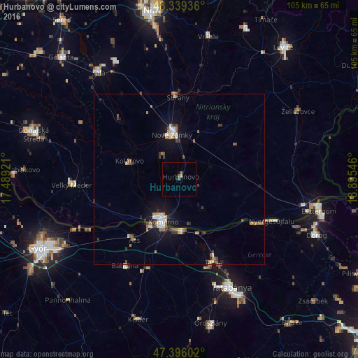
Analysis of Hurbanovo night lights 2016
Square area 10x10 km:
 0%
0%90-99
0%80-89
0.57%70-79
0.57%60-69
0%50-59
1.14%40-49
0%30-39
0%20-29
0%10-19
1.14%0-9
96.59%Square area 50x50 km:
0.38%90-99
0.49%80-89
0.29%70-79
0.33%60-69
0.47%50-59
0.67%40-49
0.37%30-39
0.58%20-29
0.39%10-19
2.61%0-9
93.43%Clear (daylight) street map image can be seen on geolist.org.
Map coordinates:
48° 20' 21.7" North, 17° 29' 21.2" East
47° 52' 11.4" North, 18° 11' 32.4" East
47° 23' 45.7" North, 18° 53' 43.7" East
Some cities around Hurbanovo sort by population:
• Nové Zámky
13.1 km =8.1 mi,  350°
350°
• Komárno
12.9 km =8 mi,  203°
203°
• Tata, HU
25.9 km =16.1 mi,  158°
158°
• Komárom, HU
15.1 km =9.4 mi, 201°
• Kolárovo
16.6 km =10.3 mi,  290°
290°
• Šurany
24.1 km =15 mi,  358°
358°
• Ács, HU
22.1 km =13.7 mi,  217°
217°
• Lábatlan, HU
26.5 km =16.5 mi,  120°
120°
3059821 (p: 8,153)
Sources (retrieved 2019-11-25):
» Earth at Night: Flat Maps 2012, 2016