Oroszlány night lights from space
Night Light of Oroszlány (Komárom-Esztergom) from space (Hungary) Src. Average luminocity for 10x10km area is 8.7401% and for 50x50km: 3.4657%.
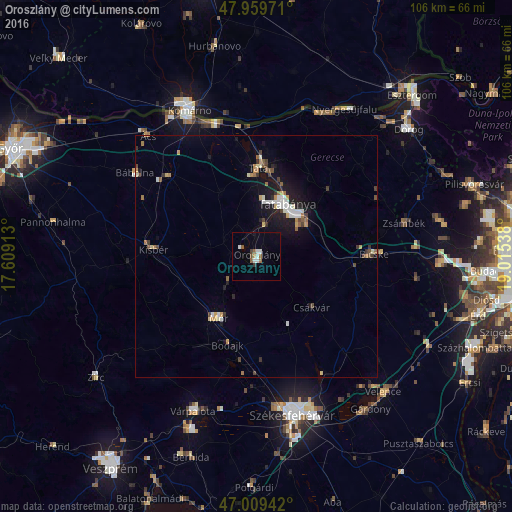
Analysis of Oroszlány night lights 2016
Square area 10x10 km:
 1.56%
1.56%90-99
1.85%80-89
0%70-79
0.57%60-69
1.14%50-59
1.7%40-49
1.14%30-39
0.57%20-29
0%10-19
0.57%0-9
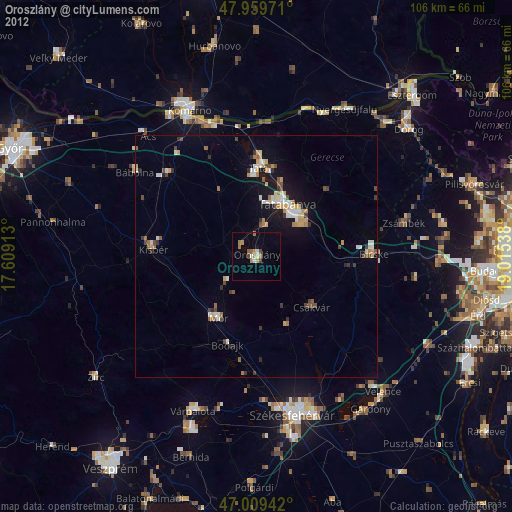
90.91%Square area 50x50 km:
0.38%90-99
0.65%80-89
0.27%70-79
0.37%60-69
0.47%50-59
0.35%40-49
0.47%30-39
0.43%20-29
0.37%10-19
2.94%0-9
93.3%Clear (daylight) street map image can be seen on geolist.org.
Map coordinates:
47° 57' 35" North, 17° 36' 32.9" East
47° 29' 12.2" North, 18° 18' 44.1" East
47° 0' 33.9" North, 19° 0' 55.4" East
Some cities around Oroszlány sort by population:
• Tatabánya
12.5 km =7.8 mi,  29°
29°
• Tata
18.5 km =11.5 mi,  1°
1°
• Komárom
32 km =19.9 mi,  333°
333°
• Mór
14.6 km =9.1 mi,  214°
214°
• Bicske
24.9 km =15.5 mi,  90°
90°
• Kisbér
20.8 km =12.9 mi,  274°
274°
• Lábatlan
32.1 km =19.9 mi, 25°
• Csákvár
15.6 km =9.7 mi,  132°
132°
3046888 (p: 20,271)
Sources (retrieved 2019-11-25):
» Earth at Night: Flat Maps 2012, 2016