Tatabánya night lights from space
Night Light of Tatabánya (Komárom-Esztergom) from space (Hungary) Src. Average luminocity for 10x10km area is 33.919% and for 50x50km: 5.5395%.
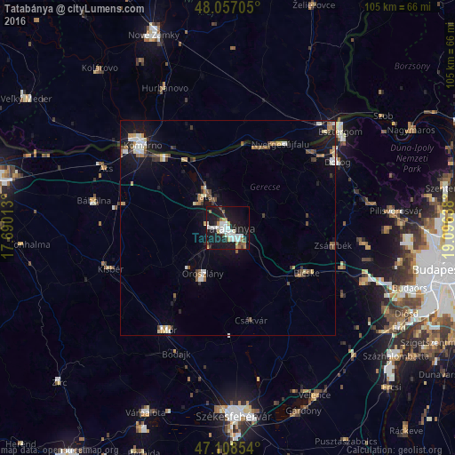
Analysis of Tatabánya night lights 2016
Square area 10x10 km:
 6.68%
6.68%90-99
9.94%80-89
1.85%70-79
2.84%60-69
3.84%50-59
1.56%40-49
2.13%30-39
2.13%20-29
5.54%10-19
48.58%0-9
14.91%Square area 50x50 km:
0.69%90-99
1.04%80-89
0.43%70-79
0.58%60-69
0.67%50-59
0.78%40-49
0.58%30-39
0.7%20-29
0.64%10-19
5.46%0-9
88.43%Clear (daylight) street map image can be seen on geolist.org.
Map coordinates:
48° 3' 25.4" North, 17° 41' 24.5" East
47° 35' 5.8" North, 18° 23' 35.7" East
47° 6' 30.7" North, 19° 5' 47" East
Some cities around Tatabánya sort by population:
• Tata
9.4 km =5.8 mi,  323°
323°
• Oroszlány
12.5 km =7.8 mi,  209°
209°
• Komárom
27 km =16.8 mi,  310°
310°
• Bicske
21.9 km =13.6 mi,  120°
120°
• Nyergesújfalu
23 km =14.3 mi,  32°
32°
• Tát
25.8 km =16 mi,  47°
47°
• Lábatlan
19.6 km =12.2 mi,  23°
23°
• Csákvár
22.1 km =13.7 mi,  165°
165°
3044082 (p: 70,541)
Sources (retrieved 2019-11-25):
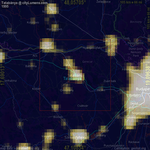
» NASA, Earths city lights 1995
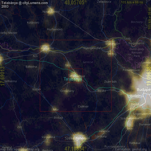
» NASA city lights 2003
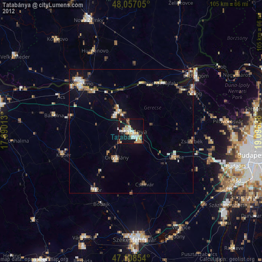
» Earth at Night: Flat Maps 2012, 2016