Tamási night lights from space
Night Light of Tamási (Tolna) from space (Hungary) Src. Average luminocity for 10x10km area is 1.7699% and for 50x50km: 0.2748%.
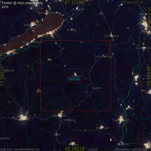
Analysis of Tamási night lights 2016
Square area 10x10 km:
 0%
0%90-99
0%80-89
0.57%70-79
0.57%60-69
0%50-59
0.57%40-49
0%30-39
0.57%20-29
0.71%10-19
0.43%0-9
96.59%Square area 50x50 km:
0%90-99
0%80-89
0.02%70-79
0.02%60-69
0.01%50-59
0.08%40-49
0.05%30-39
0.14%20-29
0.15%10-19
0.09%0-9
99.44%Clear (daylight) street map image can be seen on geolist.org.
Map coordinates:
47° 6' 50.4" North, 17° 34' 48.8" East
46° 37' 60" North, 18° 16' 60" East
46° 8' 54.1" North, 18° 59' 11.3" East
Some cities around Tamási sort by population:
• Szekszárd
45.3 km =28.1 mi,  134°
134°
• Siófok
34.7 km =21.6 mi,  330°
330°
• Dombóvár
30.7 km =19.1 mi,  201°
201°
• Paks
43.7 km =27.2 mi,  91°
91°
• Bonyhád
41.7 km =25.9 mi,  153°
153°
• Sárbogárd
38.1 km =23.7 mi,  42°
42°
• Tolna
44.6 km =27.7 mi,  121°
121°
• Enying
33.2 km =20.6 mi,  354°
354°
3044171 (p: 9,682)
Sources (retrieved 2019-11-25):
» Earth at Night: Flat Maps 2012, 2016