Enying night lights from space
Night Light of Enying (Fejér) from space (Hungary) Src. Average luminocity for 10x10km area is 0.7031% and for 50x50km: 3.104%.
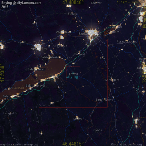
Analysis of Enying night lights 2016
Square area 10x10 km:
 0%
0%90-99
0%80-89
0%70-79
0%60-69
0%50-59
0.57%40-49
0%30-39
0%20-29
0.14%10-19
0.99%0-9
98.3%Square area 50x50 km:
0.29%90-99
0.31%80-89
0.36%70-79
0.19%60-69
0.39%50-59
0.49%40-49
0.57%30-39
0.51%20-29
0.5%10-19
2.13%0-9
94.26%Clear (daylight) street map image can be seen on geolist.org.
Map coordinates:
47° 24' 30.5" North, 17° 32' 20" East
46° 55' 49.7" North, 18° 14' 31.3" East
46° 26' 53.3" North, 18° 56' 42.5" East
Some cities around Enying sort by population:
• Veszprém
30.9 km =19.2 mi,  305°
305°
• Siófok
14.3 km =8.9 mi,  258°
258°
• Várpalota
30.9 km =19.2 mi,  345°
345°
• Sárbogárd
29.1 km =18.1 mi,  99°
99°
• Balatonfüred
28.3 km =17.6 mi,  277°
277°
• Balatonalmádi
20.4 km =12.7 mi,  304°
304°
• Polgárdi
15.2 km =9.4 mi,  17°
17°
• Berhida
21.8 km =13.5 mi,  337°
337°
3053297 (p: 7,171)
Sources (retrieved 2019-11-25):
» Earth at Night: Flat Maps 2012, 2016