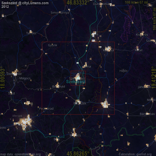
Szekszárd night lights from space
Night Light of Szekszárd (Tolna) from space (Hungary) Src. Average luminocity for 10x10km area is 13.8363% and for 50x50km: 2.2549%.
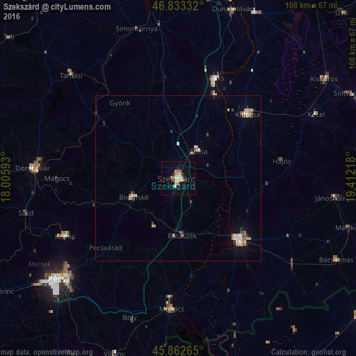
Analysis of Szekszárd night lights 2016
Square area 10x10 km:
 0.6%
0.6%90-99
2.38%80-89
3.72%70-79
1.64%60-69
1.93%50-59
1.64%40-49
0%30-39
1.79%20-29
1.04%10-19
4.02%0-9
81.25%Square area 50x50 km:
0.22%90-99
0.25%80-89
0.41%70-79
0.32%60-69
0.3%50-59
0.34%40-49
0.23%30-39
0.25%20-29
0.24%10-19
0.71%0-9
96.73%Clear (daylight) street map image can be seen on geolist.org.
Map coordinates:
46° 49' 60" North, 18° 0' 21.3" East
46° 21' 0.5" North, 18° 42' 32.6" East
45° 51' 45.5" North, 19° 24' 43.8" East
Some cities around Szekszárd sort by population:
• Baja
26.4 km =16.4 mi,  134°
134°
• Komló
38.4 km =23.9 mi,  242°
242°
• Paks
32.3 km =20.1 mi,  20°
20°
• Mohács
40.1 km =24.9 mi,  182°
182°
• Kalocsa
28.4 km =17.6 mi,  45°
45°
• Bonyhád
14.9 km =9.3 mi,  247°
247°
• Tolna
10.2 km =6.3 mi,  33°
33°
• Bátaszék
17.4 km =10.8 mi, 176°
3044760 (p: 34,174)
Sources (retrieved 2019-11-25):
» Earth at Night: Flat Maps 2012, 2016