Szombathely night lights from space
Night Light of Szombathely (Vas) from space (Hungary) Src. Average luminocity for 10x10km area is 40.5164% and for 50x50km: 3.1012%.
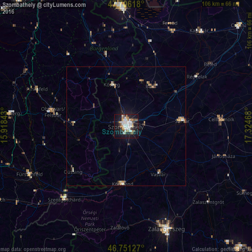

Analysis of Szombathely night lights 2016
Square area 10x10 km:
 12.2%
12.2%90-99
8.48%80-89
1.19%70-79
4.76%60-69
3.87%50-59
5.65%40-49
2.53%30-39
2.08%20-29
9.38%10-19
33.63%0-9
16.22%Square area 50x50 km:
0.55%90-99
0.47%80-89
0.23%70-79
0.47%60-69
0.29%50-59
0.46%40-49
0.43%30-39
0.25%20-29
0.68%10-19
2.19%0-9
93.98%Clear (daylight) street map image can be seen on geolist.org.
Map coordinates:
47° 42' 22.2" North, 15° 55' 6.3" East
47° 13' 51.2" North, 16° 37' 17.6" East
46° 45' 4.6" North, 17° 19' 28.8" East
Some cities around Szombathely sort by population:
• Sárvár
23.8 km =14.8 mi,  83°
83°
• Körmend
24.5 km =15.2 mi,  182°
182°
• Kőszeg
18.6 km =11.6 mi,  340°
340°
• Celldömölk
40 km =24.9 mi,  85°
85°
• Szentgotthárd
40.6 km =25.2 mi,  220°
220°
• Oberwart, AT
32 km =19.9 mi,  281°
281°
• Fürstenfeld, AT
45.4 km =28.2 mi,  243°
243°
• Pinkafeld, AT
41 km =25.5 mi,  291°
291°
3044310 (p: 79,534)
Sources (retrieved 2019-11-25):
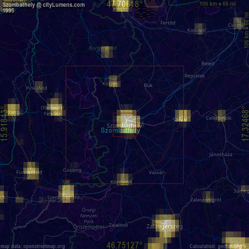
» NASA, Earths city lights 1995
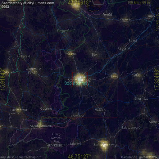
» NASA city lights 2003
» Earth at Night: Flat Maps 2012, 2016