Pinkafeld night lights from space
Night Light of Pinkafeld (Burgenland) from space (Austria) Src. Average luminocity for 10x10km area is 3.4256% and for 50x50km: 1.2401%.
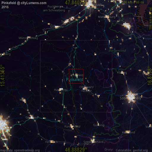
Analysis of Pinkafeld night lights 2016
Square area 10x10 km:
 0%
0%90-99
0.6%80-89
0%70-79
0.6%60-69
0.89%50-59
0.89%40-49
1.19%30-39
0%20-29
0.6%10-19
0.6%0-9
94.64%Square area 50x50 km:
0.05%90-99
0.15%80-89
0.09%70-79
0.17%60-69
0.16%50-59
0.36%40-49
0.29%30-39
0.28%20-29
0.33%10-19
0.25%0-9
97.87%Clear (daylight) street map image can be seen on geolist.org.
Map coordinates:
47° 50' 26.7" North, 15° 24' 48.8" East
47° 22' 0" North, 16° 7' 0" East
46° 53' 17.8" North, 16° 49' 11.3" East
Some cities around Pinkafeld sort by population:
• Szombathely, HU
41 km =25.5 mi,  111°
111°
• Kőszeg, HU
32 km =19.9 mi,  85°
85°
• Neunkirchen
39.5 km =24.5 mi,  356°
356°
• Weiz
41.2 km =25.6 mi,  246°
246°
• Ternitz
39.3 km =24.4 mi,  351°
351°
• Oberwart
10.9 km =6.8 mi,  141°
141°
• Gleisdorf
42.2 km =26.2 mi,  226°
226°
• Fürstenfeld
35.3 km =21.9 mi,  184°
184°
2768811 (p: 5,438)
Sources (retrieved 2019-11-25):
» Earth at Night: Flat Maps 2012, 2016