Celldömölk night lights from space
Night Light of Celldömölk (Vas) from space (Hungary) Src. Average luminocity for 10x10km area is 5.5223% and for 50x50km: 1.2237%.
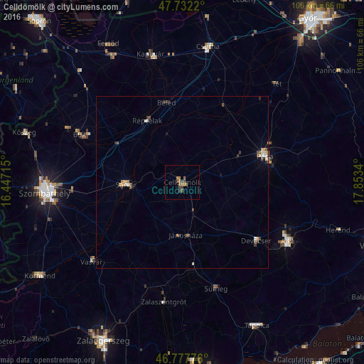
Analysis of Celldömölk night lights 2016
Square area 10x10 km:
 0%
0%90-99
0%80-89
0%70-79
0%60-69
3.57%50-59
1.19%40-49
2.68%30-39
1.49%20-29
0%10-19
0%0-9
91.07%Square area 50x50 km:
0.09%90-99
0.16%80-89
0.15%70-79
0.12%60-69
0.27%50-59
0.19%40-49
0.29%30-39
0.28%20-29
0.11%10-19
0.17%0-9
98.18%Clear (daylight) street map image can be seen on geolist.org.
Map coordinates:
47° 43' 55.9" North, 16° 26' 49.7" East
47° 15' 25.7" North, 17° 9' 1" East
46° 46' 39.9" North, 17° 51' 12.2" East
Some cities around Celldömölk sort by population:
• Szombathely
40 km =24.9 mi,  265°
265°
• Pápa
25.3 km =15.7 mi,  71°
71°
• Ajka
35.4 km =22 mi,  119°
119°
• Sárvár
16.2 km =10.1 mi, 268°
• Kapuvár
38.4 km =23.9 mi,  346°
346°
• Zalaszentgrót
35.1 km =21.8 mi,  188°
188°
• Sümeg
32.7 km =20.3 mi,  162°
162°
• Devecser
27.7 km =17.2 mi,  128°
128°
3054533 (p: 11,421)
Sources (retrieved 2019-11-25):
» Earth at Night: Flat Maps 2012, 2016