Nyíradony night lights from space
Night Light of Nyíradony (Hajdú-Bihar) from space (Hungary) Src. Average luminocity for 10x10km area is 0.5506% and for 50x50km: 3.3555%.
Analysis of Nyíradony night lights 2016
Square area 10x10 km:
 0%
0%90-99
0%80-89
0%70-79
0%60-69
0%50-59
0%40-49
0.6%30-39
0.6%20-29
0%10-19
0%0-9
98.81%Square area 50x50 km:
0.63%90-99
0.72%80-89
0.32%70-79
0.31%60-69
0.22%50-59
0.33%40-49
0.55%30-39
0.41%20-29
1.02%10-19
2.12%0-9
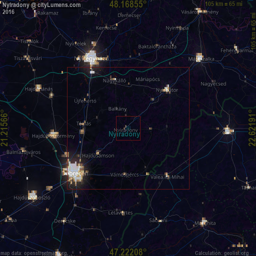
93.38%Clear (daylight) street map image can be seen on geolist.org.
Map coordinates:
48° 10' 6.8" North, 21° 12' 56.4" East
47° 41' 50.9" North, 21° 55' 7.6" East
47° 13' 19.5" North, 22° 37' 18.9" East
Some cities around Nyíradony sort by population:
• Újfehértó
21 km =13 mi,  302°
302°
• Nyírbátor
22 km =13.7 mi,  46°
46°
• Hajdúhadház
18.9 km =11.7 mi,  265°
265°
• Hajdúsámson
15.7 km =9.8 mi,  226°
226°
• Nagykálló
20.6 km =12.8 mi,  343°
343°
• Balkány
9.1 km =5.7 mi,  332°
332°
• Téglás
17.7 km =11 mi,  276°
276°
• Vámospércs
18.3 km =11.4 mi,  184°
184°
716951 (p: 7,827)
Sources (retrieved 2019-11-25):
» Earth at Night: Flat Maps 2012, 2016