Téglás night lights from space
Night Light of Téglás (Hajdú-Bihar) from space (Hungary) Src. Average luminocity for 10x10km area is 3.5164% and for 50x50km: 4.4001%.
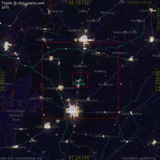
Analysis of Téglás night lights 2016
Square area 10x10 km:
 0%
0%90-99
0%80-89
0%70-79
0.45%60-69
1.34%50-59
0.3%40-49
2.38%30-39
1.93%20-29
0.45%10-19
0%0-9
93.15%Square area 50x50 km:
0.72%90-99
0.77%80-89
0.46%70-79
0.44%60-69
0.36%50-59
0.49%40-49
0.74%30-39
0.63%20-29
1.37%10-19
2.69%0-9
91.35%Clear (daylight) street map image can be seen on geolist.org.
Map coordinates:
48° 11' 15.3" North, 20° 58' 48.8" East
47° 43' 0" North, 21° 40' 60" East
47° 14' 29.3" North, 22° 23' 11.3" East
Some cities around Téglás sort by population:
• Debrecen
20.7 km =12.9 mi,  190°
190°
• Hajdúböszörmény
13.7 km =8.5 mi,  245°
245°
• Újfehértó
9.3 km =5.8 mi,  0°
0°
• Hajdúhadház
3.9 km =2.4 mi,  198°
198°
• Hajdúsámson
14.4 km =8.9 mi,  154°
154°
• Hajdúdorog
17.6 km =10.9 mi,  309°
309°
• Nyíradony
17.7 km =11 mi,  96°
96°
• Balkány
14.7 km =9.1 mi,  65°
65°
714914 (p: 6,285)
Sources (retrieved 2019-11-25):
» Earth at Night: Flat Maps 2012, 2016