Balkány night lights from space
Night Light of Balkány (Szabolcs-Szatmár-Bereg) from space (Hungary) Src. Average luminocity for 10x10km area is 0.3452% and for 50x50km: 3.7299%.
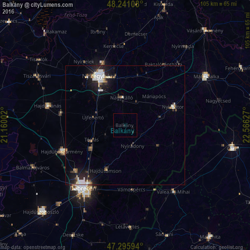
Analysis of Balkány night lights 2016
Square area 10x10 km:
 0%
0%90-99
0%80-89
0%70-79
0%60-69
0%50-59
0%40-49
0%30-39
0%20-29
0.6%10-19
0.6%0-9
98.81%Square area 50x50 km:
0.7%90-99
0.75%80-89
0.26%70-79
0.29%60-69
0.22%50-59
0.31%40-49
0.51%30-39
0.57%20-29
1.32%10-19
3%0-9
92.06%Clear (daylight) street map image can be seen on geolist.org.
Map coordinates:
48° 14' 27.9" North, 21° 9' 36.1" East
47° 46' 14.4" North, 21° 51' 47.3" East
47° 17' 45.4" North, 22° 33' 58.6" East
Some cities around Balkány sort by population:
• Nyíregyháza
23.3 km =14.5 mi,  331°
331°
• Újfehértó
13.8 km =8.6 mi,  283°
283°
• Nyírbátor
21.3 km =13.2 mi,  70°
70°
• Hajdúhadház
17.6 km =10.9 mi,  236°
236°
• Hajdúsámson
20.3 km =12.6 mi,  200°
200°
• Nagykálló
11.7 km =7.3 mi,  351°
351°
• Nyíradony
9.1 km =5.7 mi,  152°
152°
• Téglás
14.7 km =9.1 mi,  245°
245°
722650 (p: 6,798)
Sources (retrieved 2019-11-25):
» Earth at Night: Flat Maps 2012, 2016