Umag night lights from space
Night Light of Umag (Istria) from space (Croatia) Src. Average luminocity for 10x10km area is 21.5254% and for 50x50km: 8.0813%.
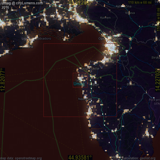
Analysis of Umag night lights 2016
Square area 10x10 km:
 2.54%
2.54%90-99
5.08%80-89
0.63%70-79
1.59%60-69
2.54%50-59
1.27%40-49
4.76%30-39
3.33%20-29
4.29%10-19
31.11%0-9
42.86%Square area 50x50 km:
1.22%90-99
1.92%80-89
0.46%70-79
0.68%60-69
0.78%50-59
0.72%40-49
1.17%30-39
1.37%20-29
1.63%10-19
7.14%0-9
82.92%Clear (daylight) street map image can be seen on geolist.org.
Map coordinates:
45° 55' 21.6" North, 12° 49' 14.8" East
45° 25' 53" North, 13° 31' 26" East
44° 56' 8.9" North, 14° 13' 37.3" East
Some cities around Umag sort by population:
• Koper, SI
20.5 km =12.7 mi,  51°
51°
• Izola, SI
15.9 km =9.9 mi,  42°
42°
• Muggia, IT
27 km =16.8 mi, 44°
• Poreč
23.5 km =14.6 mi,  166°
166°
• Grado, IT
29 km =18 mi,  341°
341°
• Lucija, SI
10.2 km =6.3 mi, 36°
• Piran, SI
11.3 km =7 mi,  18°
18°
• Ankaran, SI
23.3 km =14.5 mi, 45°
3188498 (p: 7,807)
Sources (retrieved 2019-11-25):
» Earth at Night: Flat Maps 2012, 2016