Poreč night lights from space
Night Light of Poreč (Istria) from space (Croatia) Src. Average luminocity for 10x10km area is 28.7273% and for 50x50km: 5.1052%.
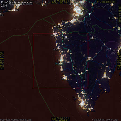
Analysis of Poreč night lights 2016
Square area 10x10 km:
 3.94%
3.94%90-99
5.45%80-89
3.79%70-79
4.09%60-69
2.27%50-59
2.42%40-49
1.97%30-39
3.79%20-29
8.48%10-19
35.3%0-9
28.48%Square area 50x50 km:
0.46%90-99
0.98%80-89
0.54%70-79
0.61%60-69
0.53%50-59
0.32%40-49
0.69%30-39
0.58%20-29
0.78%10-19
4.87%0-9
89.63%Clear (daylight) street map image can be seen on geolist.org.
Map coordinates:
45° 43' 7.5" North, 12° 53' 31.2" East
45° 13' 32.4" North, 13° 35' 42.4" East
44° 43' 41.8" North, 14° 17' 53.7" East
Some cities around Poreč sort by population:
• Koper, SI
37.2 km =23.1 mi,  16°
16°
• Rovinj
16.2 km =10.1 mi,  168°
168°
• Izola, SI
35 km =21.7 mi,  8°
8°
• Umag
23.5 km =14.6 mi,  346°
346°
• Buzet
35.5 km =22.1 mi,  54°
54°
• Lucija, SI
31.1 km =19.3 mi,  1°
1°
• Pazin
26.8 km =16.7 mi,  86°
86°
• Piran, SI
33.6 km =20.9 mi,  356°
356°
3192699 (p: 10,499)
Sources (retrieved 2019-11-25):
» Earth at Night: Flat Maps 2012, 2016