Yuscarán night lights from space
Night Light of Yuscarán (El Paraíso) from space (Honduras) Src. Average luminocity for 10x10km area is 0.2727% and for 50x50km: 0.9537%.
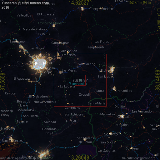
Analysis of Yuscarán night lights 2016
Square area 10x10 km:
 0%
0%90-99
0%80-89
0%70-79
0%60-69
0%50-59
0%40-49
0%30-39
0.83%20-29
0%10-19
0%0-9
99.17%Square area 50x50 km:
0%90-99
0.03%80-89
0%70-79
0.03%60-69
0.1%50-59
0.4%40-49
0.28%30-39
0.6%20-29
0.31%10-19
0.21%0-9
98.03%Clear (daylight) street map image can be seen on geolist.org.
Map coordinates:
14° 37' 31" North, 87° 33' 21.3" West
13° 56' 38" North, 86° 51' 10" West
13° 15' 37.8" North, 86° 8' 58.8" West
Some cities around Yuscarán sort by population:
• Tegucigalpa
41.2 km =25.6 mi,  291°
291°
• Danlí
30.7 km =19.1 mi,  71°
71°
• Ocotal, NI
53.5 km =33.2 mi,  130°
130°
• Somoto, NI
59.2 km =36.8 mi,  150°
150°
• El Paraíso
33.8 km =21 mi,  104°
104°
• Talanga
56.5 km =35.1 mi,  333°
333°
• San Marcos de Colón
57.1 km =35.5 mi,  174°
174°
• Villa de San Francisco
27.6 km =17.1 mi, 333°
3600165 (p: 2,371)
Sources (retrieved 2019-11-25):
» Earth at Night: Flat Maps 2012, 2016