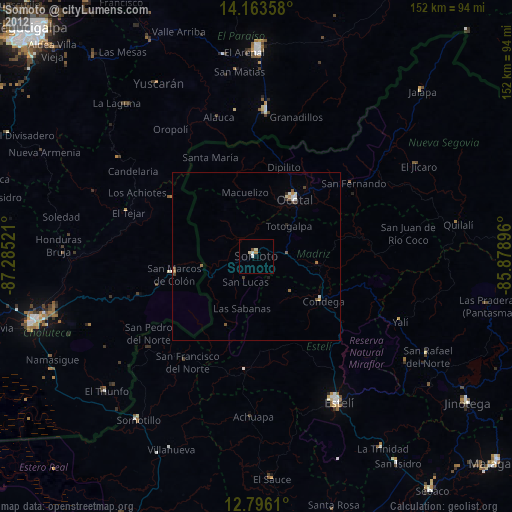
Somoto night lights from space
Night Light of Somoto (Madriz) from space (Nicaragua) Src. Average luminocity for 10x10km area is 5.1529% and for 50x50km: 1.1961%.
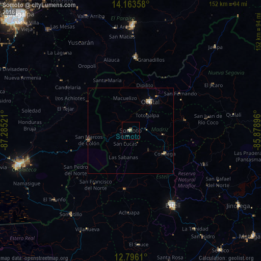
Analysis of Somoto night lights 2016
Square area 10x10 km:
 0.41%
0.41%90-99
0.41%80-89
0.83%70-79
1.65%60-69
0%50-59
0.41%40-49
1.24%30-39
0.83%20-29
2.48%10-19
0%0-9
91.74%Square area 50x50 km:
0.1%90-99
0.14%80-89
0.22%70-79
0.2%60-69
0.17%50-59
0.09%40-49
0.14%30-39
0.28%20-29
0.39%10-19
0.02%0-9
98.25%Clear (daylight) street map image can be seen on geolist.org.
Map coordinates:
14° 9' 48.9" North, 87° 17' 6.8" West
13° 28' 51" North, 86° 34' 55.5" West
12° 47' 46" North, 85° 52' 44.3" West
Some cities around Somoto sort by population:
• Estelí
49.8 km =30.9 mi,  150°
150°
• Ocotal
20.4 km =12.7 mi,  34°
34°
• El Paraíso, HN
43 km =26.7 mi,  4°
4°
• Condega
23.7 km =14.7 mi,  122°
122°
• San Marcos de Colón, HN
24.1 km =15 mi,  257°
257°
• El Triunfo, HN
60.7 km =37.7 mi,  228°
228°
• San Rafael del Norte
59.1 km =36.7 mi, 120°
• Yuscarán, HN
59.2 km =36.8 mi,  330°
330°
3616232 (p: 20,316)
Sources (retrieved 2019-11-25):
» Earth at Night: Flat Maps 2012, 2016