Chalkída night lights from space
Night Light of Chalkída (Central Greece) from space (Greece) Src. Average luminocity for 10x10km area is 47.9399% and for 50x50km: 12.7479%.
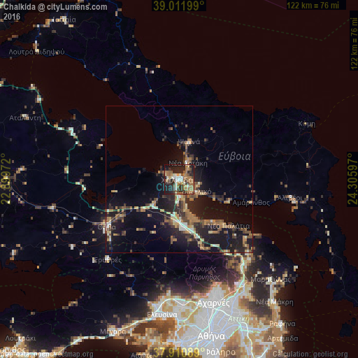
Analysis of Chalkída night lights 2016
Square area 10x10 km:
 2.76%
2.76%90-99
8.77%80-89
3.9%70-79
7.47%60-69
17.37%50-59
6.98%40-49
6.49%30-39
8.77%20-29
19.97%10-19
17.05%0-9
0.49%Square area 50x50 km:
0.5%90-99
1.44%80-89
1.47%70-79
1.35%60-69
3.31%50-59
1.56%40-49
2.1%30-39
2.93%20-29
4.44%10-19
12.08%0-9
68.82%Clear (daylight) street map image can be seen on geolist.org.
Map coordinates:
39° 0' 43.2" North, 22° 53' 59" East
38° 27' 48.7" North, 23° 36' 10.2" East
37° 54' 39.2" North, 24° 18' 21.5" East
Some cities around Chalkída sort by population:
• Thívai
29.1 km =18.1 mi,  238°
238°
• Néa Artáki
6.8 km =4.2 mi,  22°
22°
• Vasilikón
7.3 km =4.5 mi,  124°
124°
• Thrakomakedónes
39.5 km =24.5 mi,  160°
160°
• Psachná
13.3 km =8.3 mi, 15°
• Avlónas
24.9 km =15.5 mi, 161°
• Alivéri
37.9 km =23.5 mi,  97°
97°
• Dhrosiá
5.3 km =3.3 mi,  295°
295°
260133 (p: 59,125)
Sources (retrieved 2019-11-25):
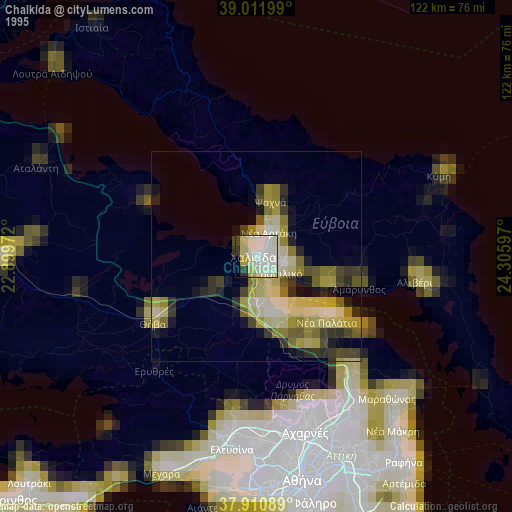
» NASA, Earths city lights 1995
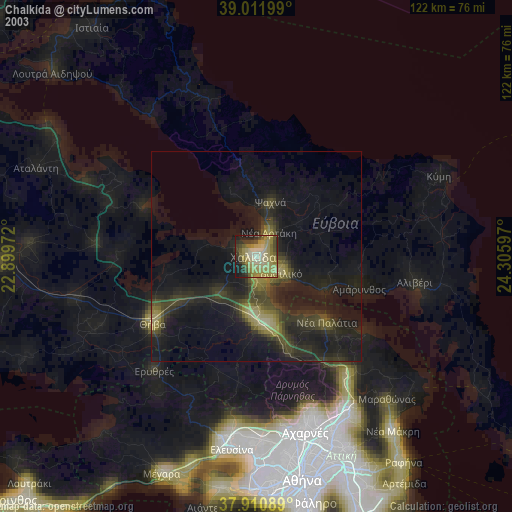
» NASA city lights 2003
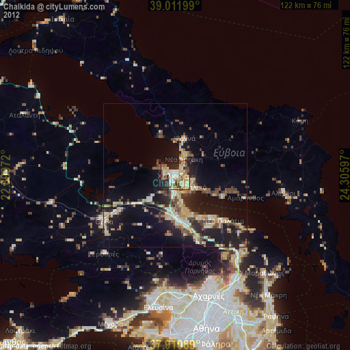
» Earth at Night: Flat Maps 2012, 2016