Artémida night lights from space
Night Light of Artémida (Attica) from space (Greece) Src. Average luminocity for 10x10km area is 52.6688% and for 50x50km: 35.1638%.
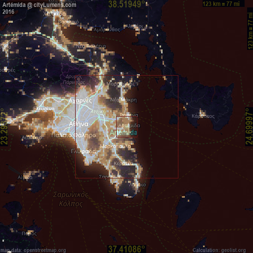
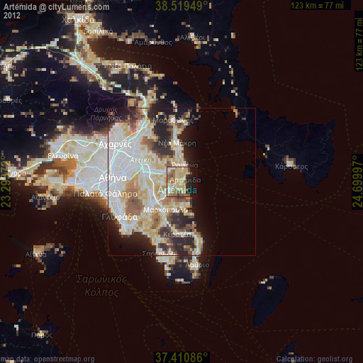
Analysis of Artémida night lights 2016
Square area 10x10 km:
 4.38%
4.38%90-99
10.23%80-89
2.92%70-79
7.31%60-69
25%50-59
12.18%40-49
6.33%30-39
2.76%20-29
6.33%10-19
17.05%0-9
5.52%Square area 50x50 km:
9.22%90-99
7.65%80-89
3.56%70-79
4.83%60-69
6.01%50-59
3.62%40-49
3.3%30-39
3.98%20-29
8.01%10-19
7.33%0-9
42.49%Clear (daylight) street map image can be seen on geolist.org.
Map coordinates:
38° 31' 10.2" North, 23° 17' 37.4" East
37° 58' 2.2" North, 23° 59' 48.6" East
37° 24' 39.1" North, 24° 41' 59.9" East
Some cities around Artémida sort by population:
• Koropí
13.3 km =8.3 mi,  235°
235°
• Pallíni
10.8 km =6.7 mi,  292°
292°
• Paianía
12.6 km =7.8 mi,  263°
263°
• Rafína
5.7 km =3.5 mi,  8°
8°
• Limín Mesoyaías
8.5 km =5.3 mi,  176°
176°
• Markópoulo
10.9 km =6.8 mi,  210°
210°
• Spáta
7.2 km =4.5 mi, 264°
• Leondárion
12.6 km =7.8 mi,  280°
280°
258038 (p: 21,488)
Sources (retrieved 2019-11-25):
» Earth at Night: Flat Maps 2012, 2016