Argos Orestiko night lights from space
Night Light of Argos Orestiko (West Macedonia) from space (Greece) Src. Average luminocity for 10x10km area is 15.1412% and for 50x50km: 2.7239%.
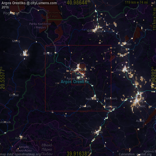
Analysis of Argos Orestiko night lights 2016
Square area 10x10 km:
 0.17%
0.17%90-99
2.55%80-89
2.38%70-79
1.36%60-69
1.53%50-59
2.89%40-49
1.87%30-39
2.89%20-29
3.06%10-19
17.18%0-9
64.12%Square area 50x50 km:
0.13%90-99
0.46%80-89
0.36%70-79
0.37%60-69
0.26%50-59
0.27%40-49
0.43%30-39
0.69%20-29
0.57%10-19
1.52%0-9
94.93%Clear (daylight) street map image can be seen on geolist.org.
Map coordinates:
40° 59' 11.2" North, 20° 33' 20.8" East
40° 27' 12.7" North, 21° 15' 32" East
39° 54' 59" North, 21° 57' 43.3" East
Some cities around Argos Orestiko sort by population:
• Korçë, AL
44.4 km =27.6 mi,  294°
294°
• Kozáni
48 km =29.8 mi,  110°
110°
• Ptolemaḯda
36.1 km =22.4 mi,  79°
79°
• Flórina
38.7 km =24 mi,  19°
19°
• Kastoria
7.6 km =4.7 mi,  2°
2°
• Grevená
43.5 km =27 mi,  160°
160°
• Bilisht, AL
29.8 km =18.5 mi,  310°
310°
• Siátista
32.2 km =20 mi,  131°
131°
736754 (p: 7,473)
Sources (retrieved 2019-11-25):
» Earth at Night: Flat Maps 2012, 2016