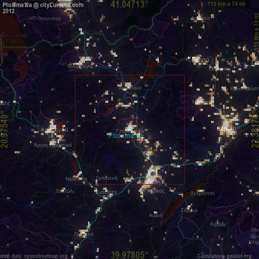
Ptolemaḯda night lights from space
Night Light of Ptolemaḯda (West Macedonia) from space (Greece) Src. Average luminocity for 10x10km area is 23.568% and for 50x50km: 6.4274%.
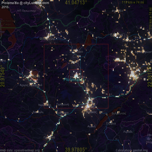
Analysis of Ptolemaḯda night lights 2016
Square area 10x10 km:
 3.74%
3.74%90-99
6.63%80-89
1.19%70-79
0.68%60-69
4.42%50-59
1.36%40-49
0.68%30-39
2.38%20-29
1.36%10-19
37.76%0-9
39.8%Square area 50x50 km:
0.48%90-99
1.11%80-89
0.52%70-79
0.72%60-69
0.97%50-59
0.74%40-49
0.87%30-39
1.15%20-29
1.22%10-19
5.15%0-9
87.07%Clear (daylight) street map image can be seen on geolist.org.
Map coordinates:
41° 2' 49.7" North, 20° 58' 31.8" East
40° 30' 53" North, 21° 40' 43" East
39° 58' 41" North, 22° 22' 54.3" East
Some cities around Ptolemaḯda sort by population:
• Véroia
44.3 km =27.5 mi,  88°
88°
• Kozáni
25.6 km =15.9 mi,  158°
158°
• Náousa
35.3 km =21.9 mi,  68°
68°
• Édessa
44.6 km =27.7 mi,  44°
44°
• Flórina
37.4 km =23.2 mi,  322°
322°
• Kastoria
35.1 km =21.8 mi,  271°
271°
• Argos Orestiko
36.1 km =22.4 mi,  259°
259°
• Siátista
30.3 km =18.8 mi,  202°
202°
734426 (p: 30,045)
Sources (retrieved 2019-11-25):
» Earth at Night: Flat Maps 2012, 2016