Bilisht night lights from space
Night Light of Bilisht (Korçë) from space (Albania) Src. Average luminocity for 10x10km area is 1.711% and for 50x50km: 1.852%.
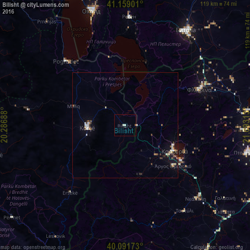
Analysis of Bilisht night lights 2016
Square area 10x10 km:
 0%
0%90-99
1.3%80-89
0%70-79
0.32%60-69
0%50-59
0%40-49
0%30-39
0%20-29
0.65%10-19
0%0-9
97.73%Square area 50x50 km:
0.18%90-99
0.44%80-89
0.16%70-79
0.15%60-69
0.19%50-59
0.22%40-49
0.23%30-39
0.36%20-29
0.26%10-19
1.17%0-9
96.64%Clear (daylight) street map image can be seen on geolist.org.
Map coordinates:
41° 9' 32.4" North, 20° 17' 12.8" East
40° 37' 39" North, 20° 59' 24" East
40° 5' 30.2" North, 21° 41' 35.3" East
Some cities around Bilisht sort by population:
• Bitola, MK
53.5 km =33.2 mi,  32°
32°
• Pogradec
41.7 km =25.9 mi,  317°
317°
• Korçë
17.7 km =11 mi,  266°
266°
• Flórina, GR
39.3 km =24.4 mi,  64°
64°
• Resen, MK
51.4 km =31.9 mi,  1°
1°
• Kastoria, GR
25.9 km =16.1 mi,  117°
117°
• Ersekë
41.6 km =25.8 mi,  219°
219°
• Argos Orestiko, GR
29.8 km =18.5 mi,  130°
130°
783606 (p: 7,114)
Sources (retrieved 2019-11-25):
» Earth at Night: Flat Maps 2012, 2016