Ystalyfera night lights from space
Night Light of Ystalyfera (Wales) from space (United Kingdom) Src. Average luminocity for 10x10km area is 2.5% and for 50x50km: 7.6648%.
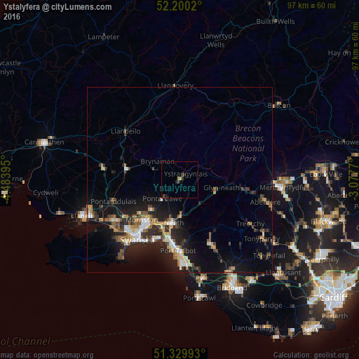
Analysis of Ystalyfera night lights 2016
Square area 10x10 km:
 0%
0%90-99
0%80-89
0%70-79
0.84%60-69
0.28%50-59
0%40-49
1.4%30-39
0.28%20-29
1.54%10-19
0.98%0-9
94.68%Square area 50x50 km:
0.84%90-99
1.1%80-89
0.57%70-79
0.95%60-69
1.08%50-59
1%40-49
1.1%30-39
1.29%20-29
2.92%10-19
6.53%0-9
82.63%Clear (daylight) street map image can be seen on geolist.org.
Map coordinates:
52° 12' 0.7" North, 4° 29' 2.2" West
51° 46' 1.8" North, 3° 46' 51" West
51° 19' 47.7" North, 3° 4' 39.7" West
Some cities around Ystalyfera sort by population:
• Neath
11.7 km =7.3 mi,  188°
188°
• Briton Ferry
15.4 km =9.6 mi, 189°
• Ammanford
14.6 km =9.1 mi,  281°
281°
• Clydach
12.4 km =7.7 mi,  221°
221°
• Pontarddulais
18.7 km =11.6 mi,  251°
251°
• Brynamman
6.9 km =4.3 mi,  301°
301°
• Glyn-neath
11.4 km =7.1 mi,  101°
101°
• Cwmafan
16.8 km =10.4 mi,  175°
175°
2633337 (p: 10,218)
Sources (retrieved 2019-11-25):
» Earth at Night: Flat Maps 2012, 2016