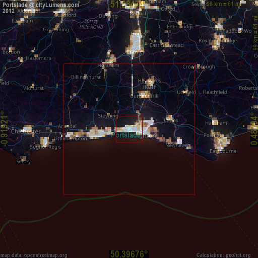
Portslade night lights from space
Night Light of Portslade (England) from space (United Kingdom) Src. Average luminocity for 10x10km area is 39.4342% and for 50x50km: 7.4426%.
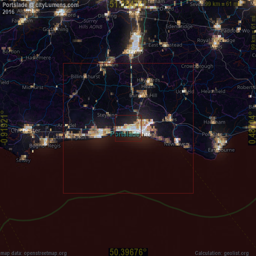
Analysis of Portslade night lights 2016
Square area 10x10 km:
 5.74%
5.74%90-99
9.66%80-89
5.74%70-79
5.18%60-69
6.3%50-59
1.96%40-49
1.26%30-39
0.42%20-29
16.81%10-19
34.87%0-9
12.04%Square area 50x50 km:
0.69%90-99
0.97%80-89
0.71%70-79
0.93%60-69
0.93%50-59
1.28%40-49
1.22%30-39
0.89%20-29
1.73%10-19
6.36%0-9
84.29%Clear (daylight) street map image can be seen on geolist.org.
Map coordinates:
51° 17' 5.1" North, 0° 55' 9.2" West
50° 50' 34.3" North, 0° 12' 57.9" West
50° 23' 48.3" North, 0° 29' 13.3" East
Some cities around Portslade sort by population:
• Brighton
5.6 km =3.5 mi,  106°
106°
• Hove
3.7 km =2.3 mi, 111°
• Shoreham-by-Sea
4.2 km =2.6 mi,  256°
256°
• Lancing
7.6 km =4.7 mi, 258°
• Hurstpierpoint
10.4 km =6.5 mi,  14°
14°
• Steyning
9.3 km =5.8 mi,  302°
302°
• Broadwater
11.3 km =7 mi, 262°
• Hassocks
10.1 km =6.3 mi,  20°
20°
2639998 (p: 20,000)
Sources (retrieved 2019-11-25):
» Earth at Night: Flat Maps 2012, 2016