Huyton night lights from space
Night Light of Huyton (England) from space (United Kingdom) Src. Average luminocity for 10x10km area is 77.7619% and for 50x50km: 42.2533%.
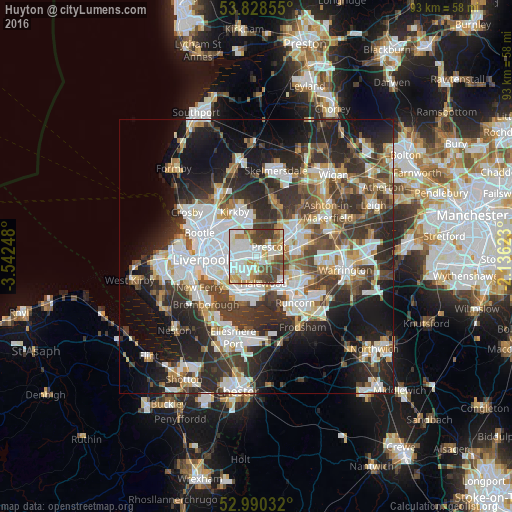
Analysis of Huyton night lights 2016
Square area 10x10 km:
 24.34%
90-99
24.6%80-89
7.41%70-79
8.2%60-69
7.8%50-59
7.28%40-49
12.17%30-39
8.2%20-29
0%10-19
0%0-9
0%Square area 50x50 km:
10.16%90-99
9.35%80-89
3.93%70-79
3.68%60-69
4.43%50-59
4.45%40-49
6.79%30-39
8.31%20-29
12.45%10-19
15.14%0-9
21.32%Clear (daylight) street map image can be seen on geolist.org.
Map coordinates:
53° 49' 42.8" North, 3° 32' 32.9" West
53° 24' 41.4" North, 2° 50' 21.7" West
52° 59' 25.2" North, 2° 8' 10.4" West
Some cities around Huyton sort by population:
• Liverpool
9.2 km =5.7 mi,  269°
269°
• St Helens
8.2 km =5.1 mi,  58°
58°
• Runcorn
10.6 km =6.6 mi,  137°
137°
• Widnes
8.9 km =5.5 mi,  128°
128°
• Kirkby
8.5 km =5.3 mi,  335°
335°
• Prescot
3.3 km =2.1 mi,  52°
52°
• Bromborough
11.6 km =7.2 mi,  232°
232°
• Rainford
10.6 km =6.6 mi,  18°
18°
2646329 (p: 54,738)
Sources (retrieved 2019-11-25):
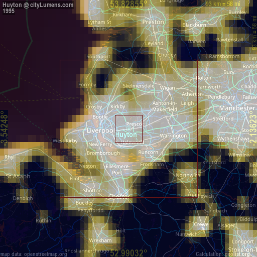
» NASA, Earths city lights 1995
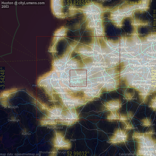
» NASA city lights 2003
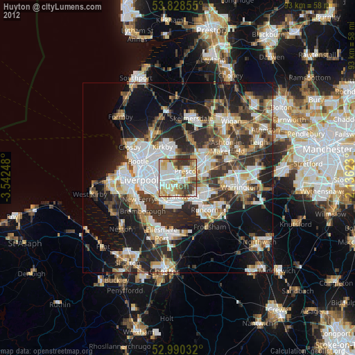
» Earth at Night: Flat Maps 2012, 2016