Jarrow night lights from space
Night Light of Jarrow (England) from space (United Kingdom) Src. Average luminocity for 10x10km area is 91.7356% and for 50x50km: 24.0654%.
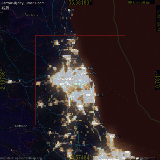
Analysis of Jarrow night lights 2016
Square area 10x10 km:
 46.89%
90-99
25.96%80-89
11.6%70-79
5.38%60-69
4.9%50-59
2.87%40-49
0.48%30-39
1.44%20-29
0.48%10-19
0%0-9
0%Square area 50x50 km:
7.42%90-99
5.3%80-89
1.97%70-79
2.01%60-69
2.25%50-59
2.22%40-49
2.07%30-39
3.9%20-29
6.27%10-19
8.03%0-9
58.54%Clear (daylight) street map image can be seen on geolist.org.
Map coordinates:
55° 22' 54.6" North, 2° 11' 14.5" West
54° 58' 49.3" North, 1° 29' 3.2" West
54° 34' 29.4" North, 0° 46' 52" West
Some cities around Jarrow sort by population:
• South Shields
3.9 km =2.4 mi,  58°
58°
• Wallsend
3.4 km =2.1 mi,  290°
290°
• North Shields
4.6 km =2.9 mi,  29°
29°
• Felling
6.3 km =3.9 mi,  241°
241°
• Hebburn
2.2 km =1.4 mi,  247°
247°
• Tynemouth
5.6 km =3.5 mi,  41°
41°
• The Boldons
4.6 km =2.9 mi,  154°
154°
• East Boldon
5.4 km =3.4 mi,  138°
138°
2645972 (p: 27,264)
Sources (retrieved 2019-11-25):
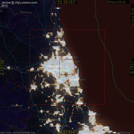
» Earth at Night: Flat Maps 2012, 2016