West Wickham night lights from space
Night Light of West Wickham (England) from space (United Kingdom) Src. Average luminocity for 10x10km area is 70.9566% and for 50x50km: 54.1904%.
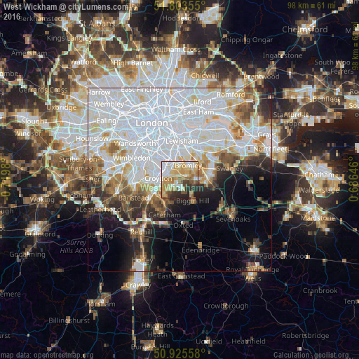
Analysis of West Wickham night lights 2016
Square area 10x10 km:
 11.76%
90-99
16.53%80-89
17.51%70-79
14.99%60-69
12.18%50-59
3.92%40-49
6.02%30-39
6.58%20-29
9.1%10-19
1.4%0-9
0%Square area 50x50 km:
24.35%90-99
12.59%80-89
4.6%70-79
3.92%60-69
4.34%50-59
3.89%40-49
3.53%30-39
3.8%20-29
5.24%10-19
7.39%0-9
26.37%Clear (daylight) street map image can be seen on geolist.org.
Map coordinates:
51° 48' 12.8" North, 0° 43' 11.3" West
51° 22' 0" North, 0° 1' 0" West
50° 55' 32.1" North, 0° 41' 11.3" East
Some cities around West Wickham sort by population:
• Croydon
6.1 km =3.8 mi,  287°
287°
• Beckenham
4.7 km =2.9 mi,  352°
352°
• South Croydon
5.4 km =3.4 mi,  264°
264°
• Thornton Heath
6.7 km =4.2 mi,  302°
302°
• Biggin Hill
6.9 km =4.3 mi,  149°
149°
• Shortlands
3.9 km =2.4 mi,  22°
22°
• Farnborough
6 km =3.7 mi,  97°
97°
• Warlingham
7 km =4.3 mi,  204°
204°
2634234 (p: 14,276)
Sources (retrieved 2019-11-25):
» Earth at Night: Flat Maps 2012, 2016