Shortlands night lights from space
Night Light of Shortlands (England) from space (United Kingdom) Src. Average luminocity for 10x10km area is 84.9678% and for 50x50km: 58.2207%.
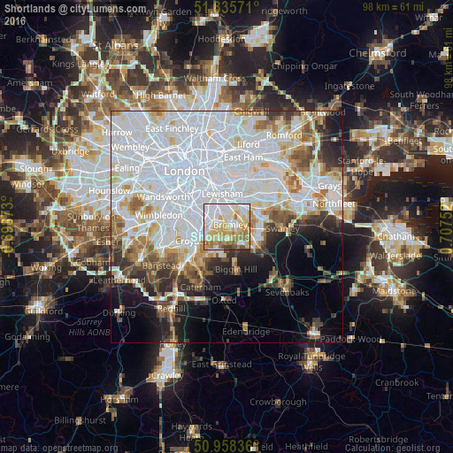
Analysis of Shortlands night lights 2016
Square area 10x10 km:
 24.09%
90-99
23.67%80-89
20.73%70-79
12.89%60-69
12.18%50-59
3.22%40-49
1.68%30-39
1.54%20-29
0%10-19
0%0-9
0%Square area 50x50 km:
26.01%90-99
13.91%80-89
5.1%70-79
4.25%60-69
4.81%50-59
4.2%40-49
3.59%30-39
3.78%20-29
5.19%10-19
7.22%0-9
21.94%Clear (daylight) street map image can be seen on geolist.org.
Map coordinates:
51° 50' 8.6" North, 0° 41' 55.4" West
51° 23' 56.9" North, 0° 0' 15.8" East
50° 57' 30.1" North, 0° 42' 27.1" East
Some cities around Shortlands sort by population:
• Beckenham
2.3 km =1.4 mi,  297°
297°
• Blackheath
7.3 km =4.5 mi,  1°
1°
• Chislehurst
4.9 km =3 mi,  65°
65°
• Orpington
7 km =4.3 mi,  112°
112°
• Thornton Heath
7.2 km =4.5 mi,  269°
269°
• West Wickham
3.9 km =2.4 mi,  202°
202°
• Sidcup
7.5 km =4.7 mi, 66°
• Farnborough
6.3 km =3.9 mi,  134°
134°
10793747 (p: 9,303)
Sources (retrieved 2019-11-25):
» Earth at Night: Flat Maps 2012, 2016