Croydon night lights from space
Night Light of Croydon (England) from space (United Kingdom) Src. Average luminocity for 10x10km area is 92.1755% and for 50x50km: 58.6067%.
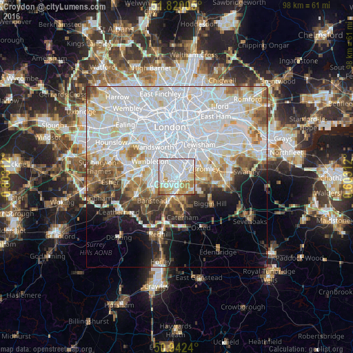
Analysis of Croydon night lights 2016
Square area 10x10 km:
 44.9%
44.9%90-99
25.85%80-89
10.61%70-79
11.29%60-69
5.99%50-59
1.36%40-49
0%30-39
0%20-29
0%10-19
0%0-9
0%Square area 50x50 km:
26.37%90-99
14.36%80-89
5.21%70-79
4.35%60-69
4.42%50-59
4.43%40-49
3.75%30-39
3.3%20-29
4.44%10-19
6.43%0-9
22.94%Clear (daylight) street map image can be seen on geolist.org.
Map coordinates:
51° 49' 12.2" North, 0° 48' 11.2" West
51° 22' 60" North, 0° 6' 0" West
50° 56' 32.6" North, 0° 36' 11.2" East
Some cities around Croydon sort by population:
• Beckenham
5.9 km =3.7 mi,  61°
61°
• Purley
5.2 km =3.2 mi,  189°
189°
• South Croydon
2.4 km =1.5 mi,  170°
170°
• Mitcham
5.2 km =3.2 mi,  295°
295°
• Morden
7 km =4.3 mi,  283°
283°
• Carshalton
5 km =3.1 mi,  250°
250°
• Thornton Heath
1.7 km =1.1 mi,  2°
2°
• West Wickham
6.1 km =3.8 mi,  107°
107°
2651817 (p: 173,314)
Sources (retrieved 2019-11-25):
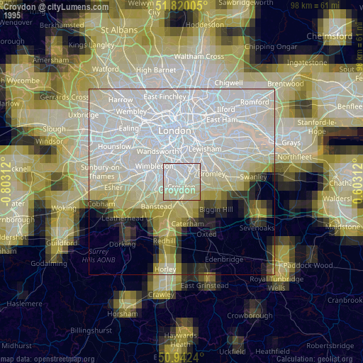
» NASA, Earths city lights 1995
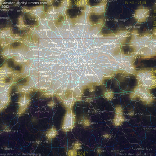
» NASA city lights 2003
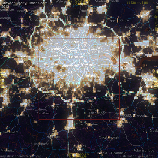
» Earth at Night: Flat Maps 2012, 2016