Thatcham night lights from space
Night Light of Thatcham (England) from space (United Kingdom) Src. Average luminocity for 10x10km area is 22.1947% and for 50x50km: 8.3612%.
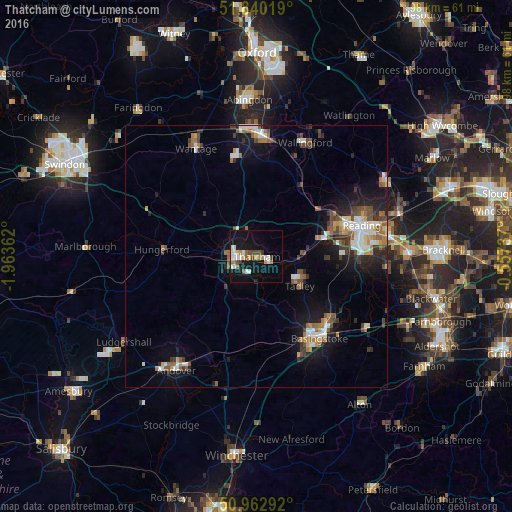
Analysis of Thatcham night lights 2016
Square area 10x10 km:
 3.22%
3.22%90-99
5.6%80-89
1.82%70-79
2.1%60-69
2.52%50-59
2.38%40-49
3.08%30-39
1.68%20-29
0.28%10-19
24.79%0-9
52.52%Square area 50x50 km:
1.09%90-99
1.44%80-89
0.55%70-79
0.71%60-69
1.41%50-59
1.17%40-49
1.4%30-39
1.21%20-29
1.81%10-19
5.96%0-9
83.25%Clear (daylight) street map image can be seen on geolist.org.
Map coordinates:
51° 50' 24.7" North, 1° 57' 49" West
51° 24' 13.2" North, 1° 15' 37.8" West
50° 57' 46.5" North, 0° 33' 26.5" West
Some cities around Thatcham sort by population:
• Reading
20.9 km =13 mi,  73°
73°
• Basingstoke
19.8 km =12.3 mi,  142°
142°
• Newbury
4.5 km =2.8 mi,  266°
266°
• Didcot
22.9 km =14.2 mi,  3°
3°
• Tadley
10.9 km =6.8 mi,  122°
122°
• Calcot
15.1 km =9.4 mi, 74°
• Hungerford
17.7 km =11 mi, 274°
• West Ilsley
15.8 km =9.8 mi,  343°
343°
2636049 (p: 24,274)
Sources (retrieved 2019-11-25):
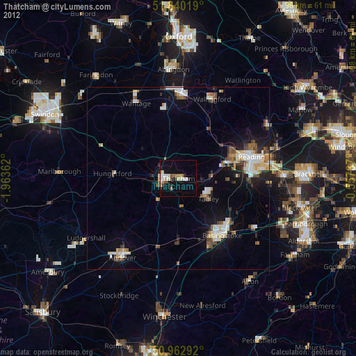
» Earth at Night: Flat Maps 2012, 2016