Wembley night lights from space
Night Light of Wembley (England) from space (United Kingdom) Src. Average luminocity for 10x10km area is 99.0869% and for 50x50km: 66.7465%.
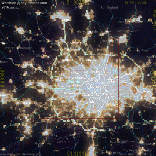
Analysis of Wembley night lights 2016
Square area 10x10 km:
 64.97%
90-99
34.22%80-89
0.8%70-79
0%60-69
0%50-59
0%40-49
0%30-39
0%20-29
0%10-19
0%0-9
0%Square area 50x50 km:
26.3%90-99
15.21%80-89
6.21%70-79
5.14%60-69
6.67%50-59
7.05%40-49
6.66%30-39
6.85%20-29
7.45%10-19
7.15%0-9
5.31%Clear (daylight) street map image can be seen on geolist.org.
Map coordinates:
51° 59' 15.1" North, 0° 59' 60" West
51° 33' 8.7" North, 0° 17' 48.7" West
51° 6' 47.2" North, 0° 24' 22.5" East
Some cities around Wembley sort by population:
• Brent
0.4 km =0.2 mi,  280°
280°
• Southall
7.1 km =4.4 mi,  226°
226°
• Acton
5 km =3.1 mi,  163°
163°
• Greenford
4.8 km =3 mi,  236°
236°
• Northolt
4.9 km =3 mi,  264°
264°
• Harrow on the Hill
3.3 km =2.1 mi,  309°
309°
• Edgware
6.9 km =4.3 mi,  12°
12°
• Greenhill
4.5 km =2.8 mi,  320°
320°
2634549 (p: 90,045)
Sources (retrieved 2019-11-25):
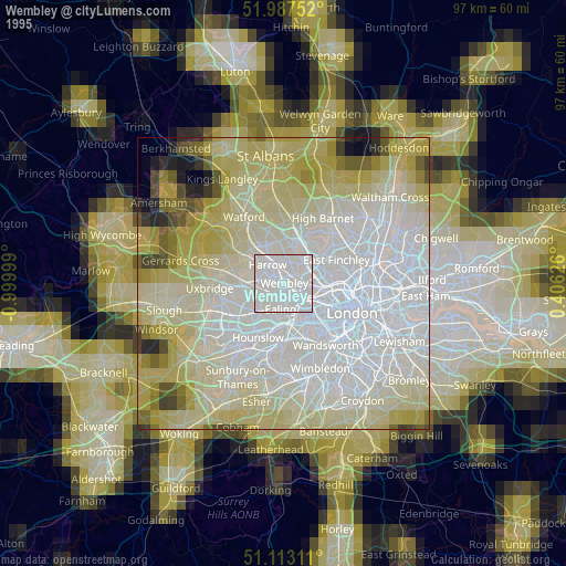
» NASA, Earths city lights 1995
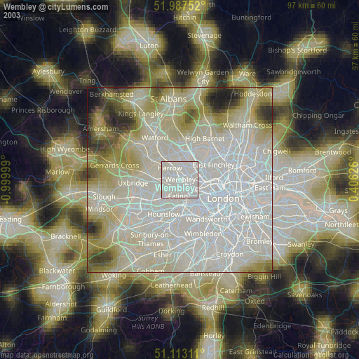
» NASA city lights 2003
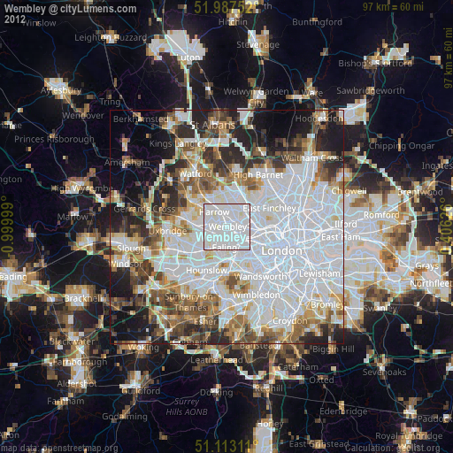
» Earth at Night: Flat Maps 2012, 2016