Wells night lights from space
Night Light of Wells (England) from space (United Kingdom) Src. Average luminocity for 10x10km area is 3.6232% and for 50x50km: 6.1538%.
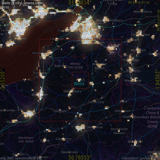
Analysis of Wells night lights 2016
Square area 10x10 km:
 0.14%
0.14%90-99
0.42%80-89
0.84%70-79
1.4%60-69
0%50-59
0%40-49
0.42%30-39
0.14%20-29
0.56%10-19
0%0-9
96.08%Square area 50x50 km:
0.62%90-99
1.03%80-89
0.57%70-79
0.64%60-69
0.77%50-59
0.89%40-49
0.95%30-39
0.7%20-29
1.42%10-19
3.71%0-9
88.71%Clear (daylight) street map image can be seen on geolist.org.
Map coordinates:
51° 38' 46.8" North, 3° 21' 7.5" West
51° 12' 28.6" North, 2° 38' 56.3" West
50° 45' 55.2" North, 1° 56' 45" West
Some cities around Wells sort by population:
• Mendip
3.6 km =2.2 mi,  25°
25°
• Street
11.2 km =7 mi,  214°
214°
• Midsomer Norton
14.3 km =8.9 mi,  52°
52°
• Shepton Mallet
7.4 km =4.6 mi,  105°
105°
• Glastonbury
8.4 km =5.2 mi,  216°
216°
• Peasedown Saint John
19.8 km =12.3 mi, 52°
• Radstock
15.9 km =9.9 mi,  55°
55°
• Cheddar
11.6 km =7.2 mi,  310°
310°
2634569 (p: 11,343)
Sources (retrieved 2019-11-25):
» Earth at Night: Flat Maps 2012, 2016