Glastonbury night lights from space
Night Light of Glastonbury (England) from space (United Kingdom) Src. Average luminocity for 10x10km area is 8.0147% and for 50x50km: 5.5767%.
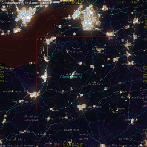
Analysis of Glastonbury night lights 2016
Square area 10x10 km:
 0.67%
0.67%90-99
1.34%80-89
1.74%70-79
0.53%60-69
0%50-59
1.34%40-49
2.41%30-39
1.07%20-29
0%10-19
1.07%0-9
89.84%Square area 50x50 km:
0.68%90-99
0.92%80-89
0.52%70-79
0.55%60-69
0.63%50-59
0.73%40-49
0.99%30-39
0.46%20-29
0.75%10-19
3.96%0-9
89.8%Clear (daylight) street map image can be seen on geolist.org.
Map coordinates:
51° 35' 11.1" North, 3° 25' 26" West
51° 8' 50.8" North, 2° 43' 14.7" West
50° 42' 15.3" North, 2° 1' 3.5" West
Some cities around Glastonbury sort by population:
• Mendip
11.9 km =7.4 mi,  33°
33°
• Bridgwater
19.8 km =12.3 mi,  263°
263°
• Burnham-on-Sea
21.8 km =13.5 mi,  297°
297°
• Street
2.9 km =1.8 mi,  207°
207°
• Wells
8.4 km =5.2 mi,  36°
36°
• Midsomer Norton
22.4 km =13.9 mi,  46°
46°
• Shepton Mallet
13 km =8.1 mi,  68°
68°
• Cheddar
14.7 km =9.1 mi,  344°
344°
2648559 (p: 8,471)
Sources (retrieved 2019-11-25):
» Earth at Night: Flat Maps 2012, 2016