Warrington night lights from space
Night Light of Warrington (England) from space (United Kingdom) Src. Average luminocity for 10x10km area is 71.1468% and for 50x50km: 49.081%.
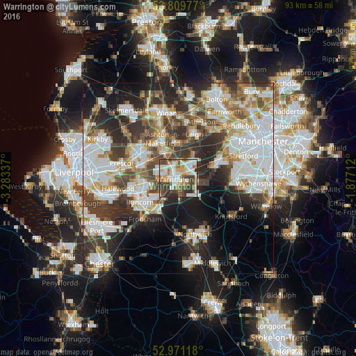
Analysis of Warrington night lights 2016
Square area 10x10 km:
 18.52%
90-99
18.78%80-89
8.07%70-79
9.66%60-69
9.13%50-59
6.61%40-49
11.38%30-39
12.43%20-29
5.42%10-19
0%0-9
0%Square area 50x50 km:
13.59%90-99
11.43%80-89
4.71%70-79
4.81%60-69
5.46%50-59
5%40-49
6.93%30-39
8.18%20-29
10.67%10-19
11.24%0-9
17.98%Clear (daylight) street map image can be seen on geolist.org.
Map coordinates:
53° 48' 35.2" North, 3° 17' 0.1" West
53° 23' 33.1" North, 2° 34' 48.9" West
52° 58' 16.2" North, 1° 52' 37.6" West
Some cities around Warrington sort by population:
• Great Sankey
4 km =2.5 mi,  269°
269°
• Golborne
9.4 km =5.8 mi,  353°
353°
• Newton-le-Willows
6.5 km =4 mi, 348°
• Lymm
6.9 km =4.3 mi,  100°
100°
• Grappenhall
3.2 km =2 mi,  135°
135°
• Partington
10.5 km =6.5 mi,  73°
73°
• Culcheth
7.6 km =4.7 mi,  31°
31°
• Stockton Heath
2.4 km =1.5 mi,  170°
170°
2634739 (p: 165,456)
Sources (retrieved 2019-11-25):
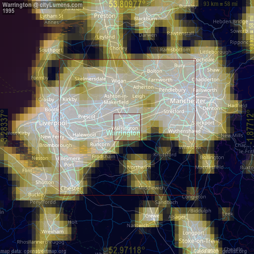
» NASA, Earths city lights 1995
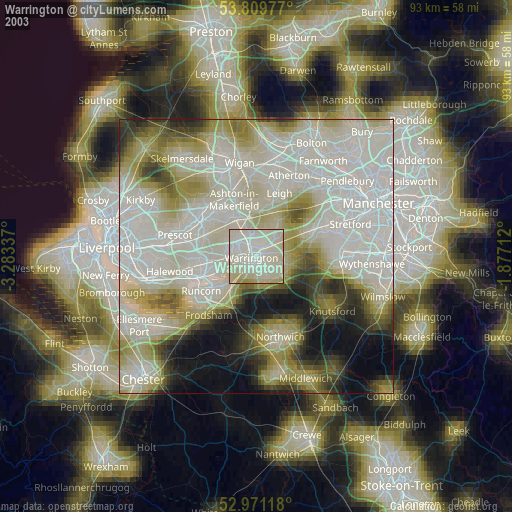
» NASA city lights 2003
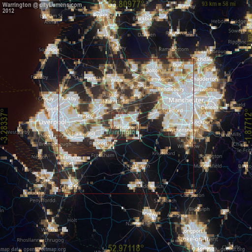
» Earth at Night: Flat Maps 2012, 2016